Atlas #5 · The island's trade, part 2 of 3
How Does a Port 209 m Above the Sea Load Its Ships?
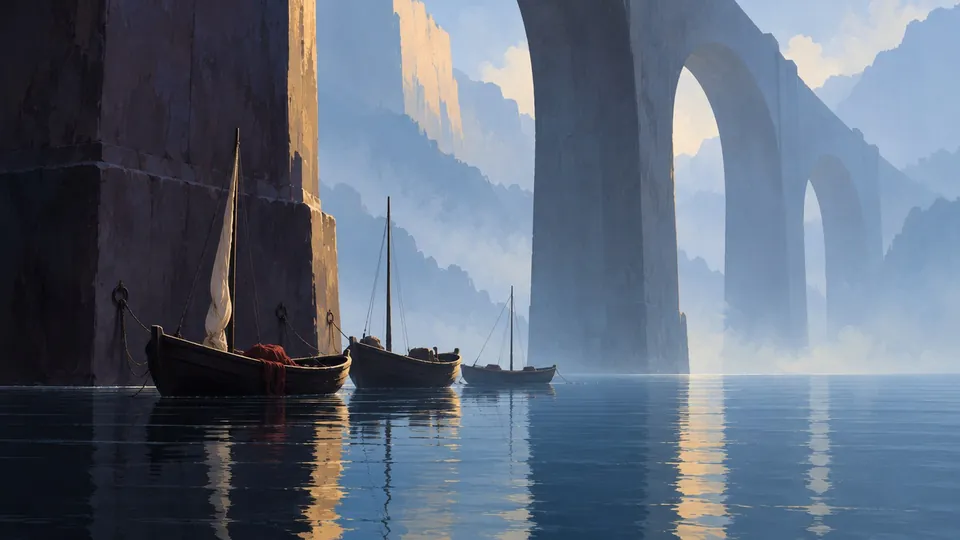
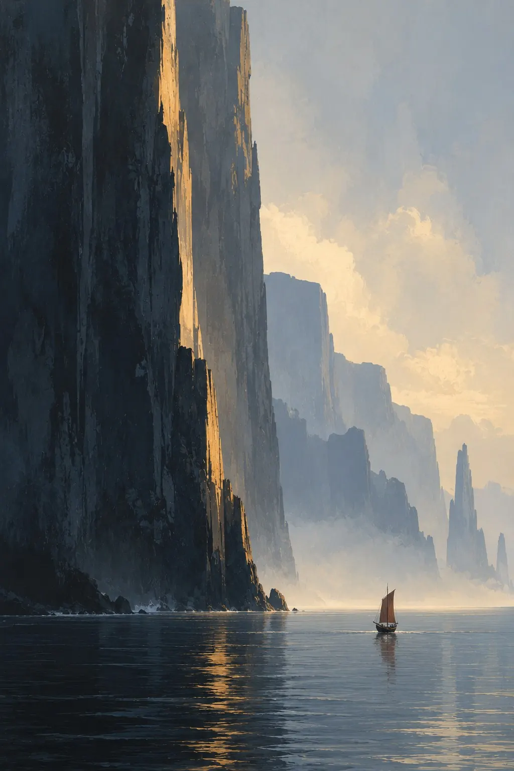
Concept art from the Atlas ontology: Sailing vessel below the coastal cliff (concept 3)
Follows on from Atlas #1: Cargo Only Floats Downhill: The River Trade of a Mountain Island
In this post
At Labuhan Harjo, a river slides over the edge of a sea wall and falls some 170 metres into the head of a sea canyon. Beside it stands a port city of 10,868 people, with 31 ships, four galleys, 152 fishing boats and about 18,900 tonnes a year to load.
The city stands 209 metres up. At the foot of the wall there is no shelf of land wide enough for a quay, only fallen rock; but off it lie some ten hectares of sheltered shallows, half a metre to four metres deep. This is a post about a procedural island's sea cliffs, the rivers that fall off them, and a game economy that has not yet looked down. We only saw it because we taught the island's maps to show how high a coast is.
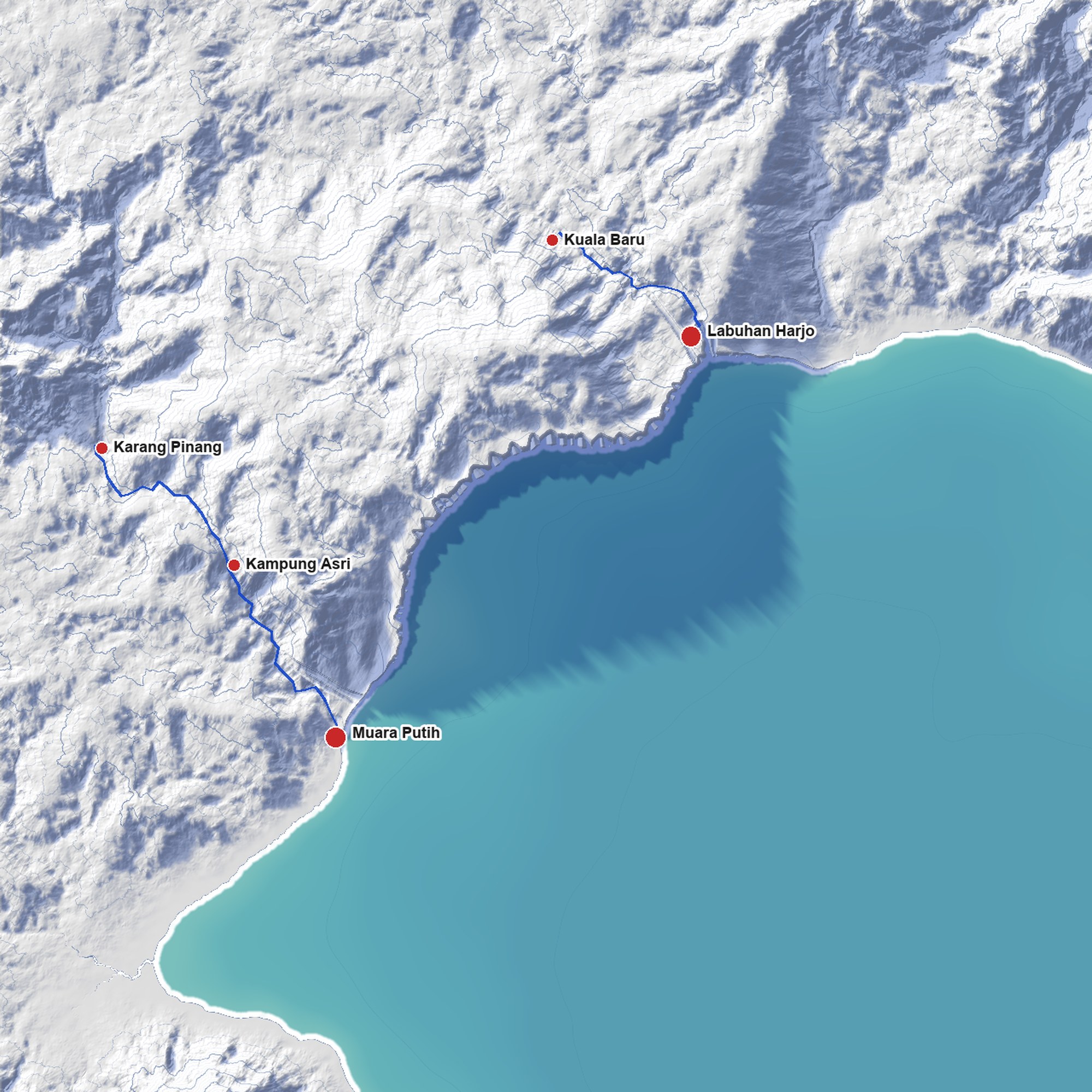
The Weeping Wall
from straight above, about 10 km across, at 8 m a pixel, drawn from the
same terrain as the island map (land identity 8edf4a5515b0be6b). Both
blues on the sea are deliberate exaggerations. The long one across the bay
is the wall's shadow under a low sun, with the relief doubled. The darker
strip along the shore is the coast's height, more on that below. The blue
lines are the rivers our trade survey measured. Follow the short one at
the top right: it runs south-east from Kuala Baru and ends at the cliff
edge beside Labuhan Harjo. Muara Putih sits at the south-west end, where
the wall runs out, its feet in the water.
A coast you can only see by its shadow#
From straight above, a 500-metre cliff is a line one pixel wide. Our first whole-island maps, drawn from the game's own terrain, made every coast look alike: a cove with a beach and the Storm Coast's walls of 600 to 700 metres, twice the height of the Eiffel Tower, were the same thin edge between paper and sea.
So the maps cheat, on purpose. Every coast throws a shadow onto the water: 20 pixels of sea for every 1,000 metres of height on the 2,400-pixel island map, so a 100-metre bluff gets two pixels and a 700-metre wall on the Storm Coast fourteen. A single sun would only darken the coasts facing away from it. Our first try did exactly that, and the cliffs facing the light vanished. So the shadow is cast from eight directions at once: the sun's side at full strength, the others between 60 and 88 percent. No real light does this. It is a cartographer's lie that tells the truth about height.
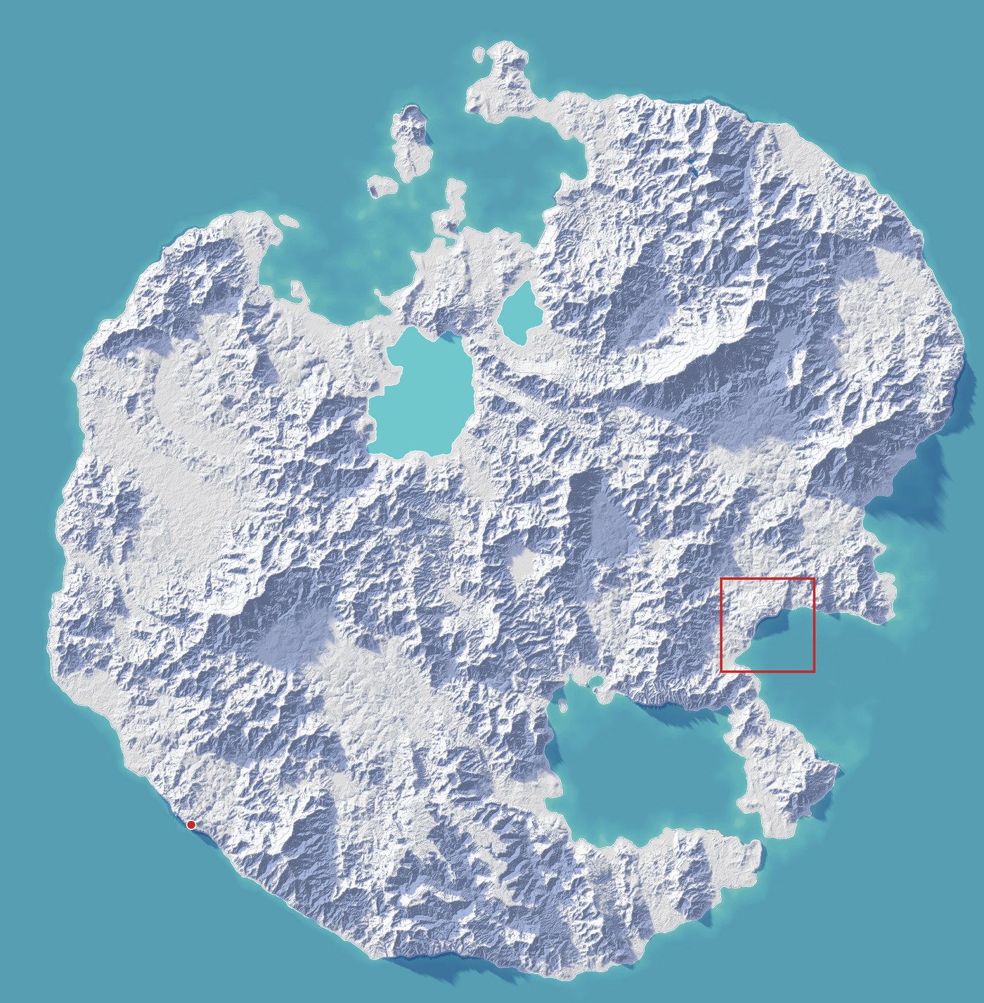
The whole island
(map.island-paper,
drawn from the terrain at Atlas commit aeead1e). The red box is the
close-up above; the red dot is Yawarchaka on the Storm Coast. Look for the
wide dark bands on the sea: those are the island's tallest walls.
Two of those walls do something no other coast on the island does.
The Weeping Wall never let its rivers down#
The Weeping Wall is a wall of soft claystone on the south-east bay, where the rain forest thins into temperate country. It rises to about 540 metres in the middle of the bay and stands about 250 to 270 metres where Labuhan Harjo looks over it. The coast rose faster than its rivers could cut down, so none of them ever carved a canyon. Each keeps its floor at the lip and falls from there straight into the sea: a dozen ribbon falls down the face, a hanging valley at the top of every one. The design asks for more: rainbows in the spray in the afternoon, when the sun stands behind anyone looking at it from the bay, and mist forest on the rim where the spray lands. Neither is in the world yet.
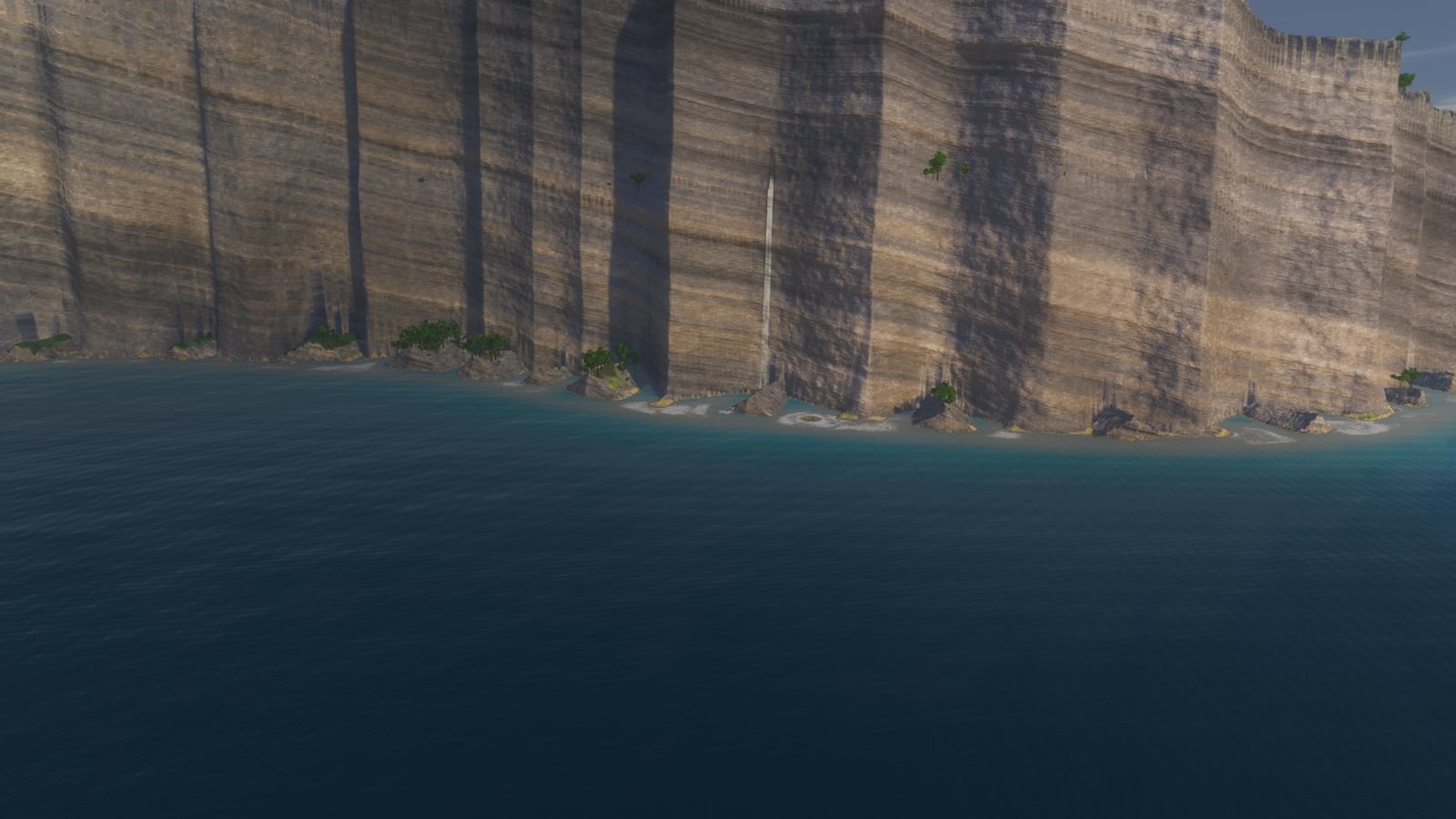
One of the Weeping Wall's falls, rendered in the engine
(render.inv-03-weeping-wall-fall-high,
Atlas commit c65fcf7, 2026-10-17). The falls are still drawn as plain
ribbons. The spray, the rainbows and the mist forest are planned, not built.
The island has 13 painted cliff coasts. Only two of them hang their rivers: the Weeping Wall, where every river falls from the very lip, and the Storm Coast in the south-west, where the walls stand 600 to 700 metres and every river leaves them partway up. Both came into the world on 3 October.
190 metres the river survey never saw#
In Cargo Only Floats Downhill, we measured every river the island's trade used. That survey reads each river where the world first lays it down: on the island before any cliff, canyon or plateau is built on top. On that land, the river from Kuala Baru runs gently down to a river mouth at sea level.
The finished island disagrees. When the blog's editor redrew the river post's maps on the new relief, the survey's water matched the ground within 10 metres at 4,817 of its 4,978 points. Five short reaches didn't. All five meet the sea at the Weeping Wall or the Storm Coast.
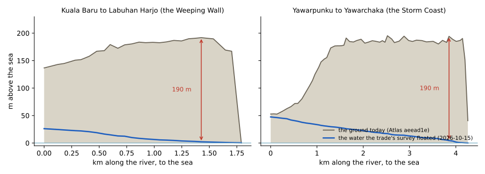
Two rivers, as the trade survey floated them (blue) and as the island stands today (grey). Near the coast, both stand about 190 m above the water the survey assumed. At the Weeping Wall (left) the ground drops to the sea in the last quarter-kilometre: that drop is the waterfall.
Under the trade's first rules, the old simulation floated 1,323 tonnes a year down the Kuala Baru river, all the way to the lip of a drop of some 170 metres. On the Storm Coast it sent 879 tonnes down to Yawarchaka, a Peruvian-inspired village of 308 that stands at 409 metres, about a hundred metres from where its river leaves the wall at some 190. The river post's new rules took that cargo off both rivers. They fall 19.5 and 14.7 metres in their steepest kilometre, and even rapids, under those rules, carry goods only up to 5 metres a kilometre, so the goods go by land. The rules were right for a reason nobody had seen yet.
So who loads the ships?#
Here is the plain answer, part by part.
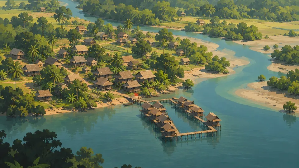
What runs today. In the island's record, Labuhan Harjo is a stilt village. Our settlement generator sited it where a river met the sea, on the same cliff-less land the survey reads, on ground it wrote down as 3.29 metres above the sea. On 4 October the settlements became a fixed record: nothing moves or resizes a town after that. Today the same spot stands 209 metres up. The trade simulation knows that Labuhan Harjo is a port. It does not know how high anything stands. So it loads 18,874 tonnes a year onto ships at the city and unloads 10,685, and keeps 90 percent of the city's granary stock and nearly all its warehouse goods by the harbour. That harbour, as far as the terrain goes, would sit 209 metres below the streets, where the wall stands in the water.
Where the land comes down. Two places on this coast are at the water. A kilometre and a half east of the city, Teluk Tinggi, a stilt village of 542, stands three metres above the sea and 75 metres from it; its one approved concept shows houses on posts and a red flag on the jetty. The economy ships almost nothing there: 220 tonnes out a year, 440 in, one ship. Five kilometres south-west, where the wall runs out, the stilt hamlet of Muara Putih has 93 people, no ships of its own, and loads 22,999 tonnes a year onto other people's. Nine tenths of it is firewood. Pack trains bring it down from villages in the eastern rain forest, Tanah Sari, Kampung Asri and Pasir Putih the most, 136 trains on an average working day, and ships carry it west. Their first ports of call are Kiltarn, for some 7,500 tonnes of it a year, and Ardbach, for 6,100: the hamlet that ships the east's firewood west. In the river post, firewood left the island's rivers for carts, from 67,000 tonnes a year by water to 13,000, and Ardbach stood at the foot of the busiest river system. Now ships land firewood at Ardbach from the far side of the island. On the busiest night, 15 ships lie at Muara Putih's quay.
The model counts room, not hands: berths, places for pack trains, stores. It does not ask whether 93 people can load 22,999 tonnes, and a settlement does not grow to its traffic. The numbers say where the goods go, not yet who carries them.
Labuhan means anchorage.
What is decided, and what is open. On 18 October, seven water towns were chosen. Teluk Tinggi is one, with about 300 of its people to live on the water. Labuhan Harjo gains a quarter of about a thousand people in stilt houses on the water, with the harbour's warehouses on piles beside them. The way up is Tangga Labuhan, the Harbour Stair, at the sea canyon's mouth. Two stone stair bridges climb at 35 degrees, each on a single rampant arch: 102 metres from the water to a landing at 74 metres, then 120 metres back to one at 158. From there a flight of 299 steps, cut into the canyon's west wall, climbs to the rim at 209 metres, and a path of 113 metres leads into the town. It is not the most practical way up. It is the fantastical one. The stair is in the island's road record now; in the game its two spans still stand empty, waiting for their stones. There is no hoist and no cart road: people and pack animals will carry the harbour's goods up and down it, about 29,500 tonnes a year by sea, some 100 tonnes every working day. The land below the city has no room for any of it: along the wall's foot, the largest patch of low ground is about a hectare. The water does. Where the river falls it is seven metres deep, but within a kilometre of the city, about 13 hectares of sea lie half a metre to four metres deep within 250 metres of the shore, some ten of them sheltered. None of it is built yet, but the economy already counts the quarter's people: 205 households over the water, each keeping a boat, so some fourteen new boats a year, nearly all from the town's own carpenters. Exactly where it stands is for the town generator to lay, with a plan shown first.
This is not unprecedented. Bonifacio in Corsica stands on cliffs about 70 metres above the sea, and its harbour, la marine, lines the narrow shelf of the inlet below. Its most famous way down, the King of Aragon's Staircase, has 187 steps. Legend says besieging soldiers cut it in one night in 1420. More likely it is older and led to a spring.
One map, every coast's height#
The two maps behind this post are now on the ontology site, where the island's 900 settlements sit on the paper relief. There is also the same island in the tactical map's colours, map.island-biome: green lowland, the snowbound north in white and blue, the sandstone south, the black basalt of the Lava Tip. Every picture records which version of the terrain it was drawn from, and the tool that draws them refuses to draw from an older one. When the island changes, the maps know they are out of date.
Drawing the shadows also turned up a bug. Near the island's centre, a rectangle of ground about 6 by 12 kilometres has straight, ruler-cut edges in the relief. No real land does that. A fix is proposed and not yet started, so today's maps still show it.
A city of 10,868 and a hamlet of 93#
Stand on the Weeping Wall at Labuhan Harjo and look down: a river falling some 170 metres into the head of a sea canyon, the sea filling the canyon below it, and at the wall's foot only fallen rock. Look east: a kilometre and a half away, at Teluk Tinggi, the land comes down to the sea. Turn south-west. Five kilometres along the coast, pack trains loaded with firewood are coming down to a hamlet whose quay holds fifteen ships on a busy night.
Upriver, at the head of the falling river, sits the hamlet of Kuala Baru. Its name means new river mouth. It stands 167 metres up, a kilometre and a half from the lip where its river falls.
In the shallows below the city, the piles of a thousand houses and a harbour's warehouses are still to be driven. Every sack that leaves Labuhan Harjo by sea will go down 1,211 stone steps. Whose back will carry it?