Atlas #1 · The island's trade, part 1 of 3
Cargo Only Floats Downhill: The River Trade of a Mountain Island
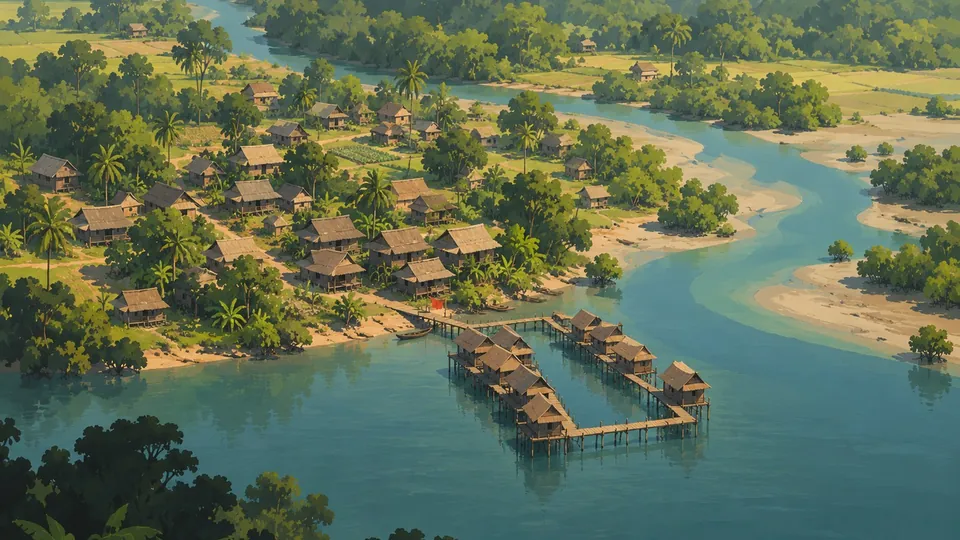
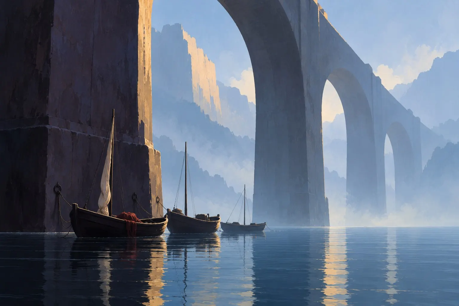
Concept art from the Atlas ontology: Boats beneath the viaduct (concept 55)
Updated 23 October 2026: Historical references for the Isar example clarified.
In this post
- Why we went and measured the rivers
- Every river runs by two laws
- The island is all slope
- Ninety-two percent
- Three ways to read a steep river
- Meet the river boat (and say goodbye to the barge)
- Ninety-eight villages for one woodpile
- What a traveller would see
- Nine bridges in two and a half kilometres
- Where this stands
- The raft question
On our island, 92 percent of everything that travels by river travels downhill. When we finally measured the rivers, that one number decided which boats exist and which bridges have to be rebuilt. It also decided why boatmen on the rapids above Ardbach spend their afternoons walking empty boats back up the bank on a rope.
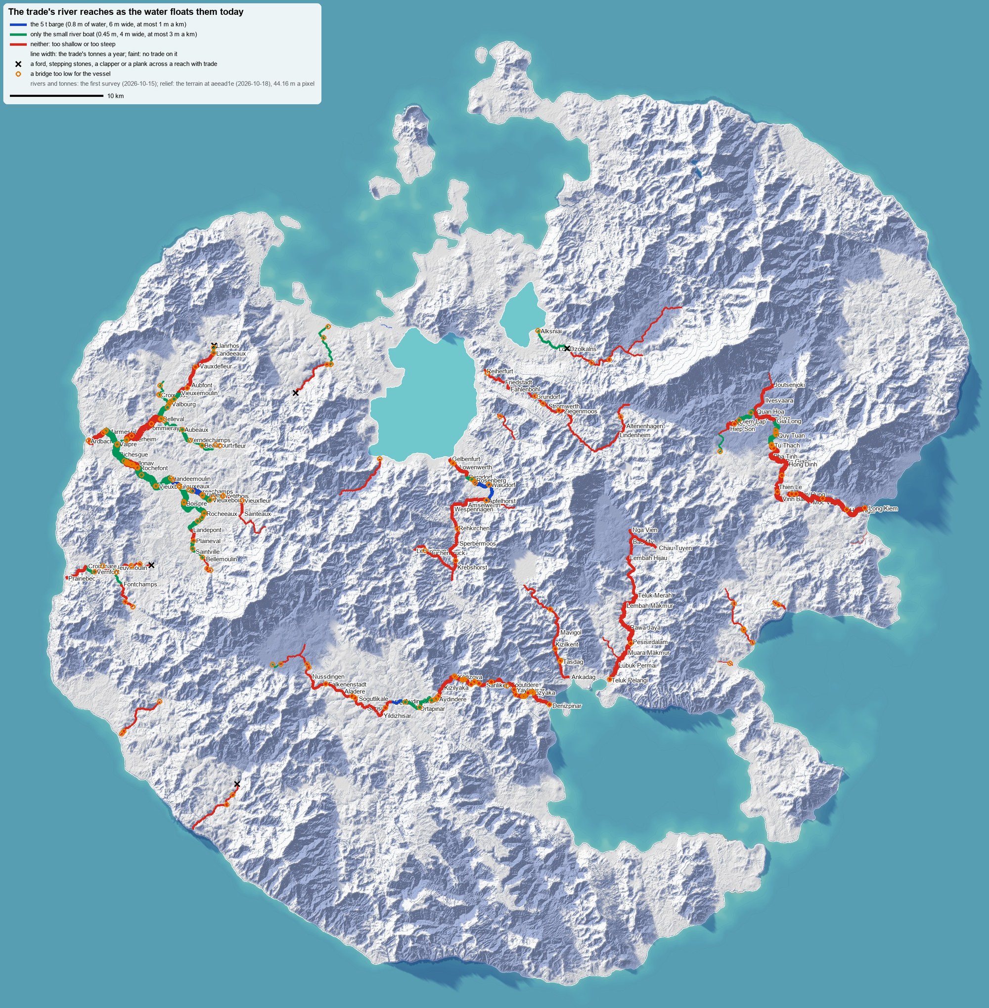
The first survey: every river our island's trade used, coloured by what its water could actually float. Blue for the river barge, green for only a small flat boat, red for neither. Line width is the cargo the old simulation sent along it each year. Black crosses are fords, orange rings bridges too low for a boat. Look at the west coast, where the busiest river system fans out above the city of Ardbach. Then look east, at the thick red line running straight down to Teluk Pelangi: a river of cargo where no boat could go. The island beneath is a paper relief of the game's own terrain, drawn three days after the survey (terrain aeead1e); the rivers and their tonnes are the survey's.
Why we went and measured the rivers#
Atlas is a game set on one island, about 131 km across, with roughly 900 settlements. They are not decoration. Every village keeps a ledger: what its people need, what its fields and workshops make, what is left over. A trade simulation then moves each surplus to someone who lacks it, by the cheapest way there is: ox carts and mule trains on the roads, coastal ships between harbours, boats on the rivers.
A second program, our town builder, reads those ledgers and lays out every town to fit them: the fields and the market, and on the quay, how many berths the barges need.
That is where the trouble started. The town builder went to place barge berths and measured the water first. Our river barge draws 0.6 m. The water beside most barge towns was 0.4 to 0.5 m deep. At ten of the seventeen barge towns it tested, there was nowhere deep enough to float one.
The obvious next question was hard to hear. Had anyone checked that the rivers the trade used were wide enough, deep enough, free of fords, and under bridges high enough for a boat? Nobody had. The simulation took any river 6 m wide as navigable, full stop.
It had been routing about 3,000 tonnes of barge traffic a year down the river from Buchenbruck to Krebshorst. That reach falls 209 m in 4 km, and 103 m of it in a single kilometre. That is not a river a barge sails down. It is a waterfall with a cargo manifest.
Every river runs by two laws#
Rivers in Atlas are not painted on. They are grown: rain falls on the terrain, water finds its way downhill, and each stretch of river carries the water of everything uphill of it. From that flow, two laws give every river its shape:
- Width grows with the square root of the flow: a river carrying a cubic metre a second is about 11 m wide.
- Depth grows more slowly, roughly with the flow to the power 0.4. That is how real rivers behave: double the water and a river gets wider sooner than it gets deeper.
The roads read the same laws to decide where they need a bridge and where a ford will do. The renderer reads them to decide how much water to draw.
The day before this survey, we had already changed one of them. The island's rivers were too thin: they ran off rain like a dry lowland, not a wet mountain island. We gave them two and a half times the water, but only in the depth law. The widths stayed exactly as they were, because every bridge, ford and riverside town had been built to fit them. Rivers got 43 percent deeper without moving a single bank.
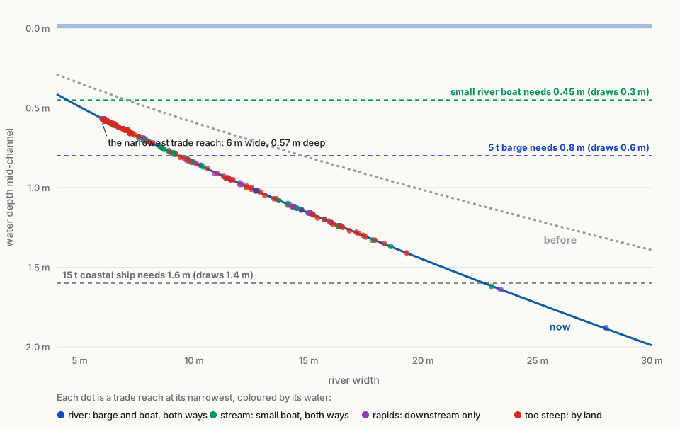
Depth against width, mid-channel, before and after the change. Each dot is a trade reach at its narrowest. Every one of them now has at least 0.57 m of water, enough for a flat river boat. The barge needs a river about 9 m wide; 88 of 162 reaches are. A coastal ship would need a river 23 m wide, and only a few stretches near the sea come close. The ships stay at sea.
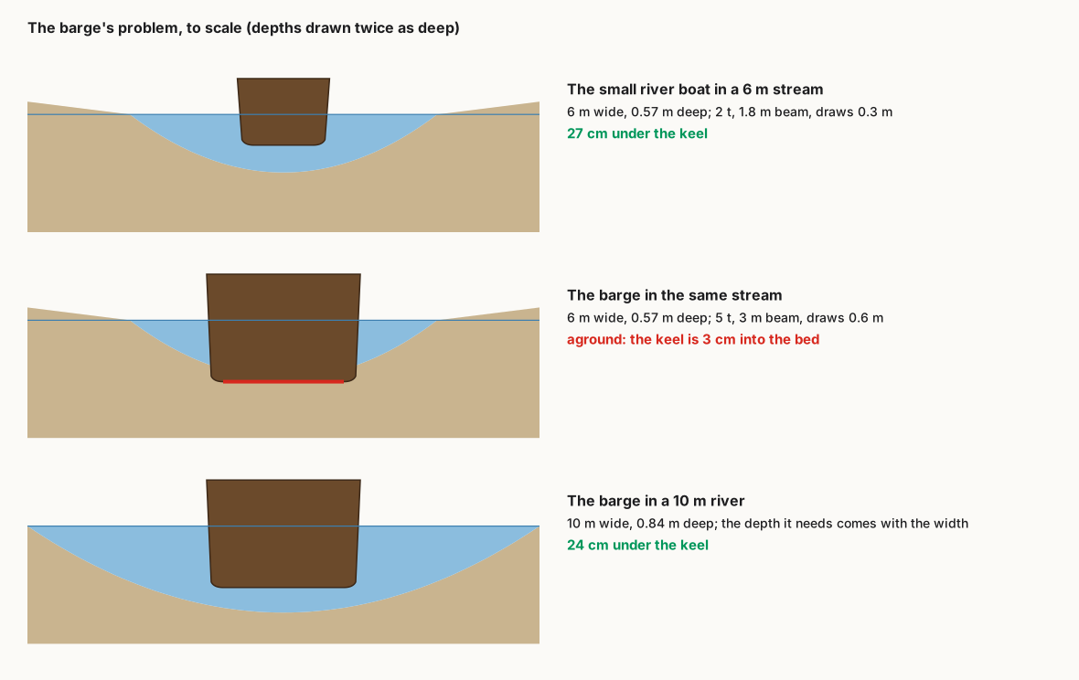
The town builder's problem, drawn to scale. In a 6 m stream the barge sits 3 cm into the gravel; a flat river boat drawing 0.3 m has a hand's breadth to spare.
So the depth turned out to be fine. The survey's real surprise was somewhere else.
The island is all slope#
We measured all 162 river stretches the trade uses: 373 km of water between one landing and the next. For each one we found its steepest kilometre.
A river that falls a metre in a kilometre already runs fast. Boats work it, but going up is hard: poled, towed from the bank, sailed when the wind allows. In our rules, nobody works a boat upstream against more than three metres a kilometre. Downstream still works, with skill.
The median trade reach on our island falls 7.9 m in its steepest kilometre. Thirty fall more than 20 m.
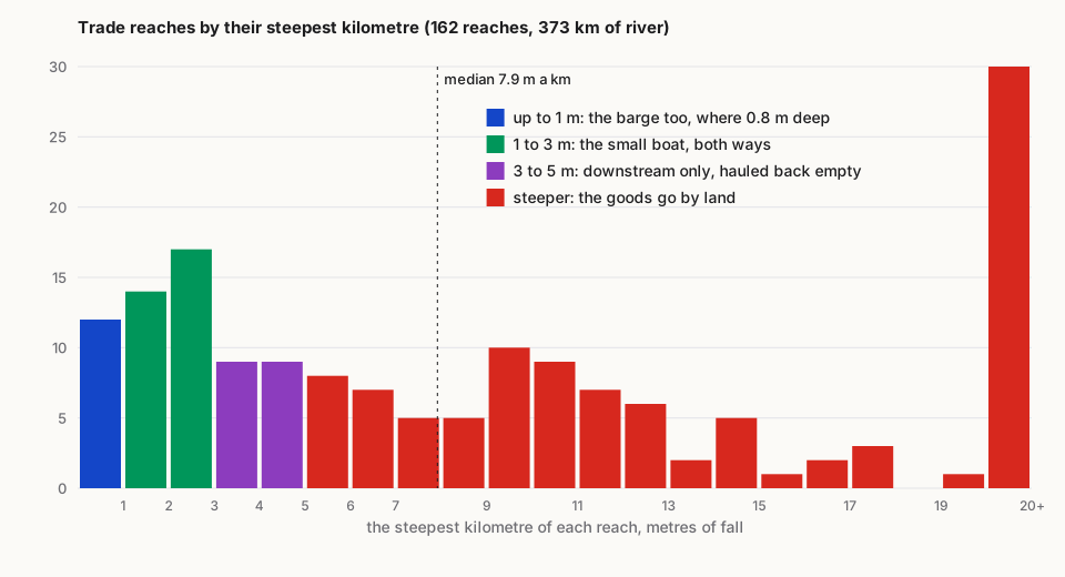
The steepest kilometre of every reach the trade used. Only the blue and green bars can be worked both ways. The tall red bar on the right is thirty stretches of white water.
It makes sense once you see it. Atlas's island is a composed, exaggerated
landscape: ranges, canyons and cliffs hundreds of metres high, packed into
an island you can ride across in a few days. Its rivers are short, and they
come down fast. Most of them are what the ontology calls
river.torrent in
their upper courses,
and many calm down only in their last few kilometres before the sea.
Ninety-two percent#
Then we looked at which way the cargo went. Of all the tonnage the old simulation sent by river, 92 percent went downstream.
And what was it? Not wine, not silk. Firewood: 67,000 tonnes a year, floating down to the towns. Then manure for the fields (28,000 t), milk, hay, building stone, timber and barley: heavy, cheap, bulky things that cost more to cart than they are worth.
Nothing in the code says "send things downhill". It falls out of three facts meeting:
- What is heavy and cheap, firewood above all, is worth moving only by water.
- Where it comes from and where it goes. The woods and pastures lie up the valleys; the hearths crowd into the towns below.
- What it costs. Going up a river costs three times what going down does, so whatever goes inland finds a road instead.
The rivers had become one-way conveyor belts long before we knew it.
That gave us a way out. If the river trade is almost all downstream, a steep river is not useless. It is only useless going up.
Three ways to read a steep river#
We laid out three rules for the reaches too steep to work both ways:
| If the steep reaches… | Reaches worked | River cargo kept |
|---|---|---|
| carry nothing above 3 m a km | 43, 86 km | 43% |
| carry cargo downstream only, up to 5 m a km | 62, 120 km | 55% |
| carry cargo downstream only, up to 8 m a km | 81, 161 km | 67% |
History had already tried the middle one. On the Hozu river west of Kyoto, boats carried timber and rice 16 km down through the gorge from 1606 until the railway came. Then the boatmen hauled the empty boats back up by rope, every day, along paths you can still see beside the river. On the Isar in Bavaria, rafts of mountain timber brought firewood, lime and even Italian wine down to Munich, by 1870 the largest raft port in Europe.
The strict rule would have done something cruel to the island's busiest river. The western plains' rivers come down to the sea at Ardbach, and their main stem carried some 34,000 tonnes a year. The strict rule would have cut it at two short stretches that fall just over three metres a kilometre: 1.5 km below Rochefont, and the last 2.4 km into the city.
We chose downstream only up to 5 m a kilometre. Above that, the goods go by land.
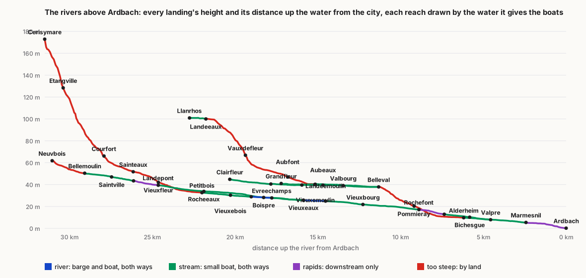
The rivers above Ardbach, every landing's height against its distance up the water. Follow the arm from Clairfleur: boats work it as far as Belleval, where it drops off an escarpment (red) that no boat can run, down past Pommieray to Alderheim. The arm from Vieuxbourg has one short rapid below Rochefont. The two meet at Valpre, and the last stretch into Ardbach is purple: boats come down it loaded and go back up it on a rope.
Meet the river boat (and say goodbye to the barge)#
The trade needed a new boat: a flat river boat of 2 tonnes, 9 m long and 1.8 m wide, drawing 0.3 m. Like the punt, it is poled and towed up the gentle streams. Unlike a punt, it is run down the rapids loaded and hauled back up empty. Two boatmen work each one. The economy now has them as an establishment of their own, the river boatmen: 481 outfits across the island, where there used to be 536 barges.
Then we reran the island's trade, and the barge vanished.
Not one tonne went by barge. The water deep and gentle enough for a barge adds up to 9 km, scattered in six short pieces between steeper streams. A barge cargo would have to change boats at both ends of each piece. The small boat simply runs through. Geography out-competed the barge.
The barges used to carry 149,200 tonnes a year; the river boats now carry 50,200. Ox carts and mule trains take on 65,000 tonnes more. The coastal ships take 15,700 more, because some cargo that left the rivers simply goes round by sea.
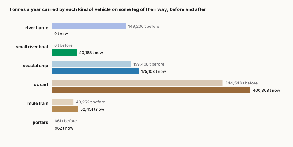
Tonnes a year carried on some leg of their journey, by vehicle. The barge does not shrink, it disappears.
The rivers' biggest cargo changed too. Firewood fell from 67,000 tonnes a year to 13,000, most of it now carted. The new leader is manure, at 18,000 tonnes. The little boats of the western plains spend most of their days carrying dung.
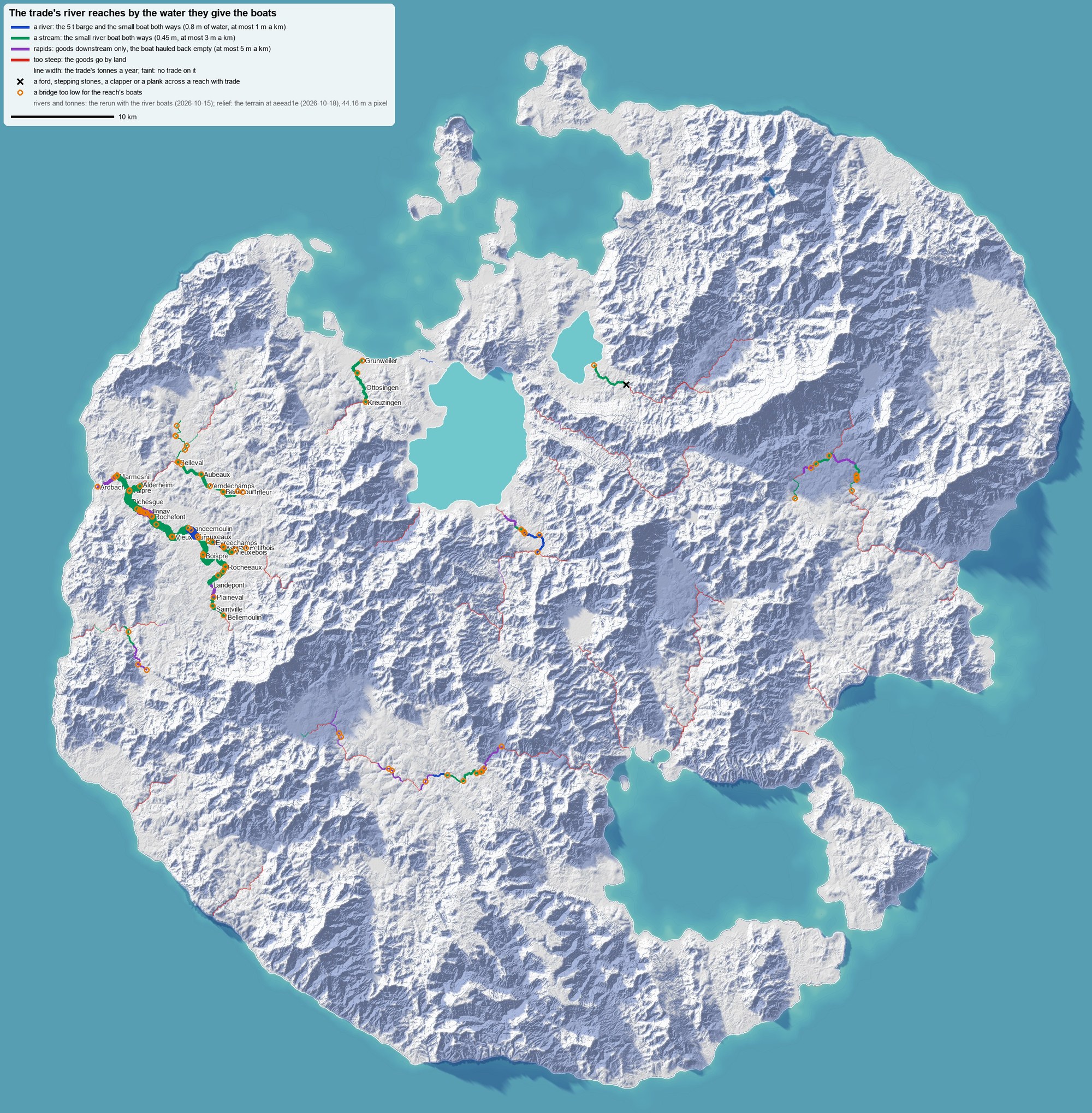
The island's river trade after the change, coloured by the water each reach gives the boats: blue a river (barge and boat), green a stream (the small boat both ways), purple rapids (downstream only), red too steep. The red rivers are now hairlines: nothing moves on them. The western plains carry almost everything. Same relief, same rivers, new rules.
Ninety-eight villages for one woodpile#
Change one rule and the island rearranges itself.
Hvalvagur is a Nordic-inspired harbour town of 3,423 people; the name means whale bay. It burns about 6,600 tonnes of firewood a year. Under the old rules, half of it came from a single village in the rain-forest east: Phuc Son, 284 people. Its wood floated 30 km down to the coast at Long Kiem by barge, then sailed 82 km to Hvalvagur.
Phuc Son's river turned out to be rapids. Its boats now stop at Quy Tuan after 8.5 km, and the wood rides 20 km by ox cart along a forest track to the sea. The cost doubled, and Phuc Son now sells its firewood to Farnheim instead.
Hvalvagur's merchants did what merchants do. Its woodpile now comes from 98 villages: 14 Nordic, 15 Finnic-Baltic, 17 Arabic-inspired and 28 in the Peruvian-inspired highlands.
The island did not find that wood at once. The trade simulation works in rounds: match what is short to what is spare, order the rest from villages with hands to spare, recalculate, repeat. After six rounds, Hvalvagur and the town of Kaltenberg were still 1,157 tonnes short of firewood, which would have been a cold year. It took eight rounds for the island to find them their wood.
What a traveller would see#
Stand on the bank of the rapids below Marmesnil, on the last stretch into Ardbach, and watch for an hour:
- A boat comes down. It is loaded from the valley above, and two boatmen keep it straight with poles. It is round the bend in a few minutes and at the quays of Ardbach in under half an hour.
- A boat goes up. It is empty, and the same two boatmen walk the bank towing it on a rope. At about two and a half kilometres an hour, the stretch takes them an hour.
- Carts on the road above. They carry what Ardbach sends inland: salt above all, 925 tonnes a year, then rope and lime. None of it goes up by water.
That asymmetry spreads into everything. Ardbach, a city of 12,000 at the river mouth, receives the valley's goods by boat, cheaply. What it sends back inland pays for oxen.
Alderheim, the bigger city upstream with 37,600 people, has it stranger still. Above it is the escarpment; below it the water is gentle only as far as Marmesnil. A city that size can work its boats both ways on about four kilometres of river.
Belleval, at the top of the escarpment, is where the boats stop and the carts begin. Some 3,550 tonnes a year come off the boats there onto ox carts, most of it firewood and hay bound for the towns below the drop. Under the old rules, Belleval, a village of 1,162 people, had no carters' yard at all. Now it keeps fourteen. Nobody placed them there. The slope of a river did.
Nine bridges in two and a half kilometres#
The survey's last job was the crossings. Our road network grew over the terrain like a fungus, joining settlements by the easiest ground. A road builder then decides, crossing by crossing, what to build: a ford, stepping stones, a timber trestle, a packhorse bridge or a stone arch. It decides by the water, the slope, the realm's building stone and how important the road is.
Not one of those choices asked whether a boat would need to pass under.
On the reaches the trade uses, roads cross the water 358 times by bridge. Half of those bridges stand less than 2 m above the water, and a quarter less than 0.8 m: fine for a cart, a wall for a boat. On the 54 reaches where boats now carry cargo, 111 of 133 bridges are too low, and one ford is left.
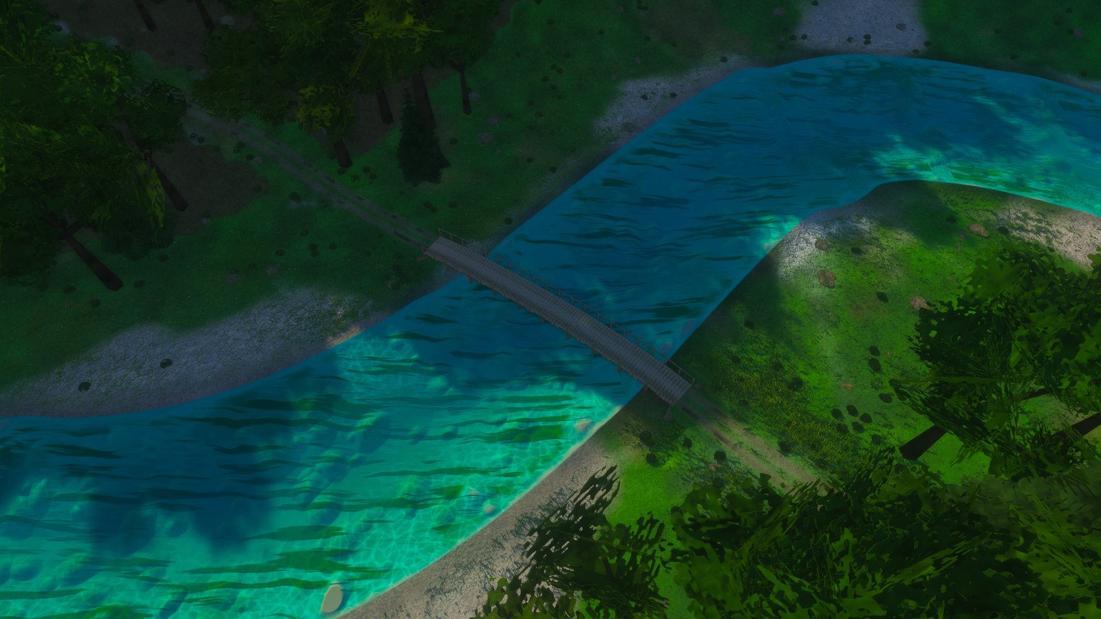
A timber bridge low over a river: lovely to cross, impossible to pass under. The water is our experimental river shader: you look through the surface to a stony bed, shallows paling to turquoise over sand.
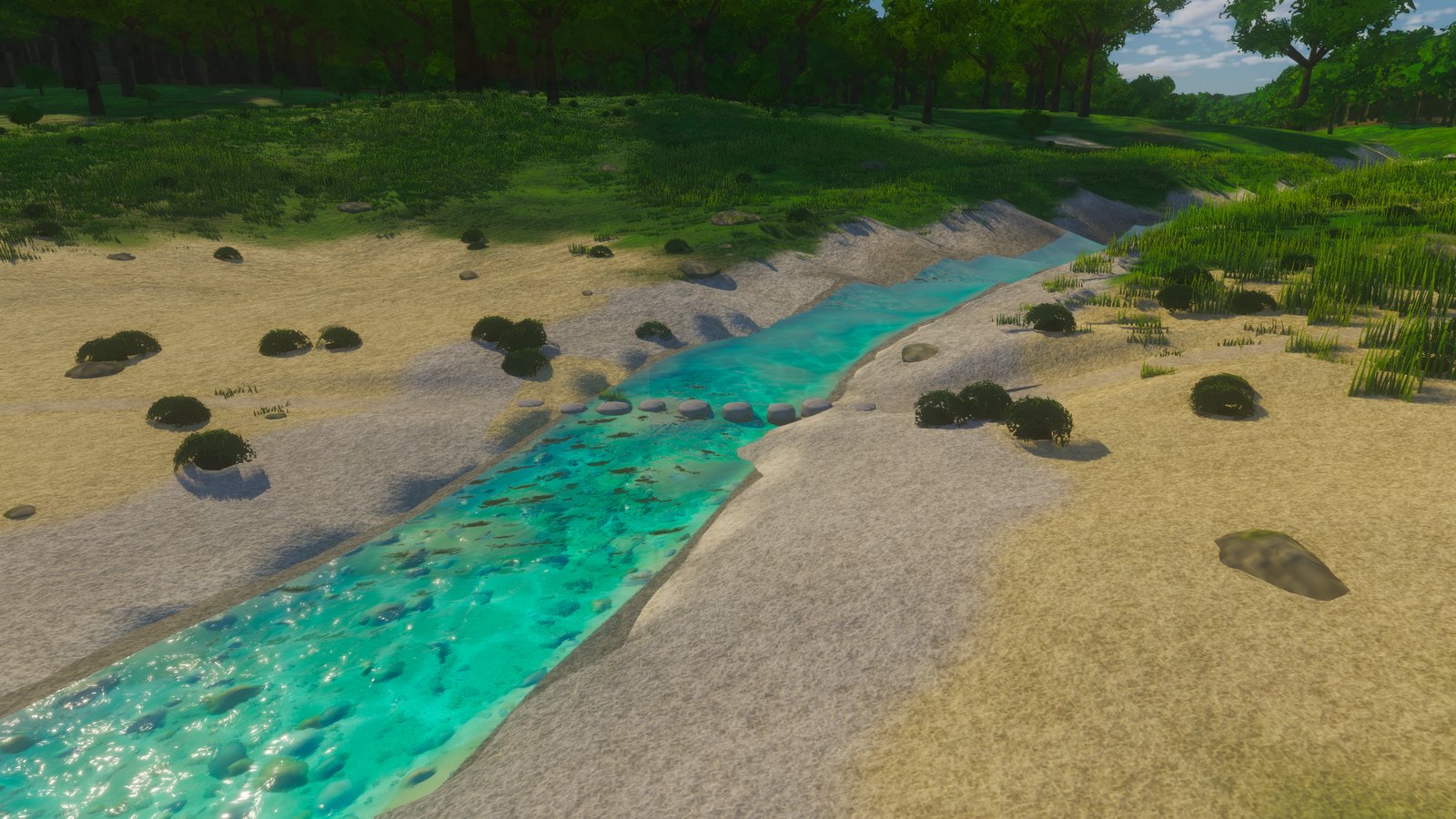
Stepping stones across a stream. For walkers, perfect. For a boat, a weir.
And sometimes a road and a river simply cannot leave each other alone:
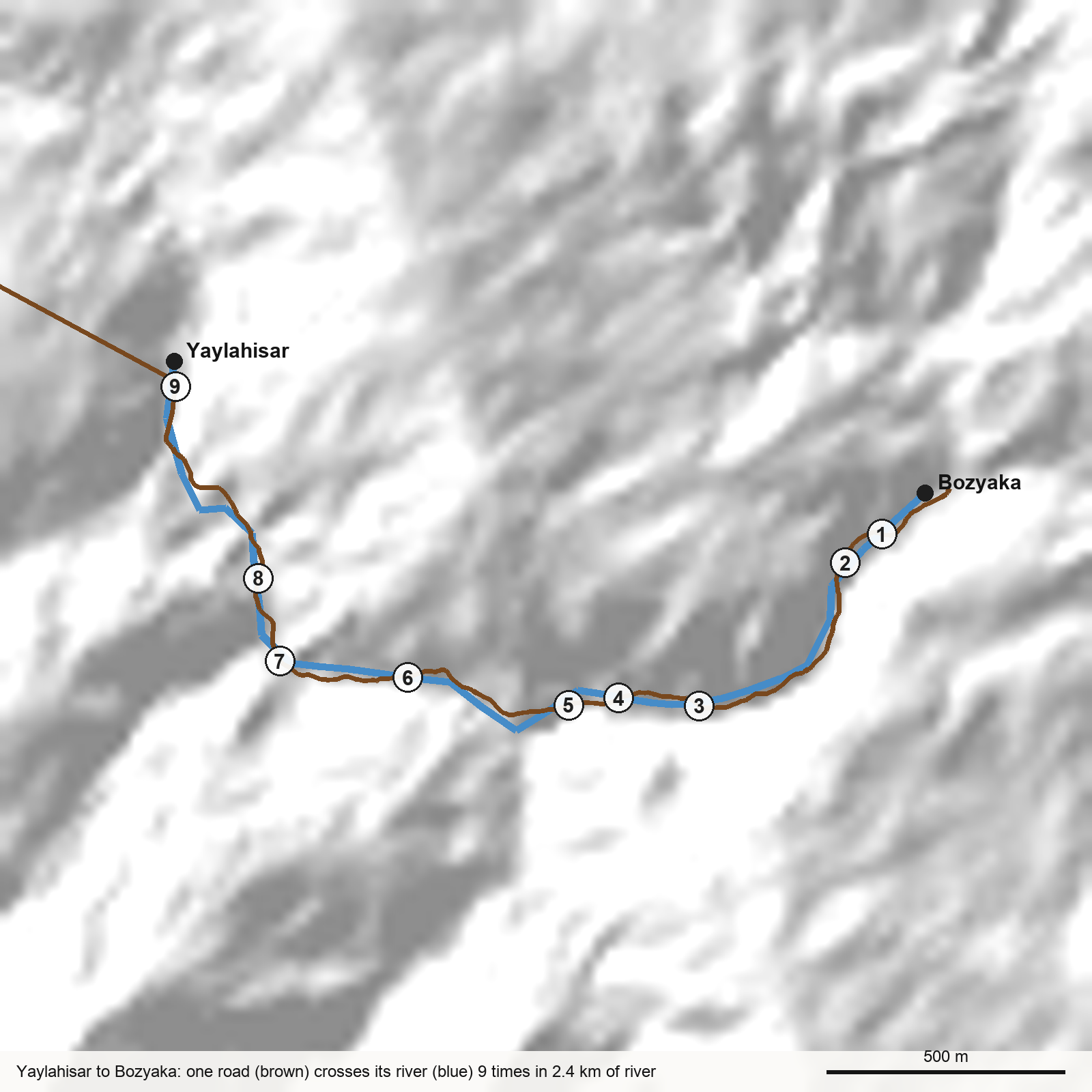
Between Yaylahisar and Bozyaka, in the island's Turkish-inspired south, the valley floor is barely wider than the river. The road takes the flattest ground it can find, and that ground keeps switching banks. Nine crossings in 2.4 km of river, most on stone arches a metre above the water. This reach falls too steeply for boats anyway, so here the bridges may stay low. A traveller would remember it as the valley where you are never dry for long.
The plan, which is not built yet, is for every bridge over a reach boats work to get a navigation arch: one span high enough for a boat. That is more than a hundred bridges for the road builder to raise. It is also a decent reason for a town to put a toll on its bridge.
Where this stands#
Running in the simulation today - The survey of all 162 trade reaches: their width, depth, fall, crossings and cargo. - The rule deciding what each reach carries: both ways, downstream only, or nothing. - The small river boat in the trade, the river boatmen in the economy, and their berths passed to the town builder.
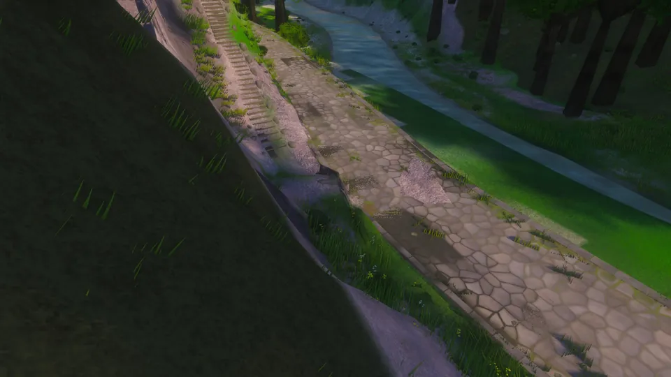
Experimental - River beds you can see into. The renders above come from it. Blind AI critics, shown our frames beside a reference photo of a real turquoise river, score them 3 to 4 out of 10 at the last count. We iterate one change at a time until they come close.
Planned - Navigation arches over the reaches boats work. - Boats on the water that you can watch, and towpaths along the rapids. - Rafts.
The raft question#
Rafts are where this gets strange. A raft is the boat and the cargo at once. Built from upland timber, floated down with goods on top and taken apart for its timber at the end, it ties the river trade to the forest itself.
Give our island rafts and a valley's trade becomes a function of its trees. Then what happens to a river town the year its forest runs out?
A detail for close readers. Five settlements on the trade's rivers are named for fords: Gelbenfurt, Reiherfurt, Wildesfurt, Tannenenfurt and Dornfurt (Furt is German for ford). Not one of their reaches has a ford any more. The roads there cross by bridge. The names remember a crossing the road builder has since bridged over. Or they remember nothing, and whoever named them was simply fond of fords.
Another. The old simulation floated oxen, sheep and pigs down the rivers on barges, about 7,000 tonnes of livestock a year. It still puts them in boats now. Livestock should walk, driven along the roads by drovers. The drovers have not come yet.