Atlas #8 · The island's water, part 1 of 2
2,585 Hollows and Three Lakes
In this post
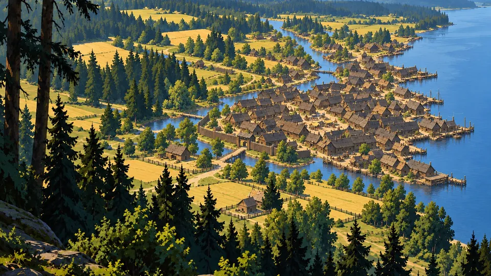
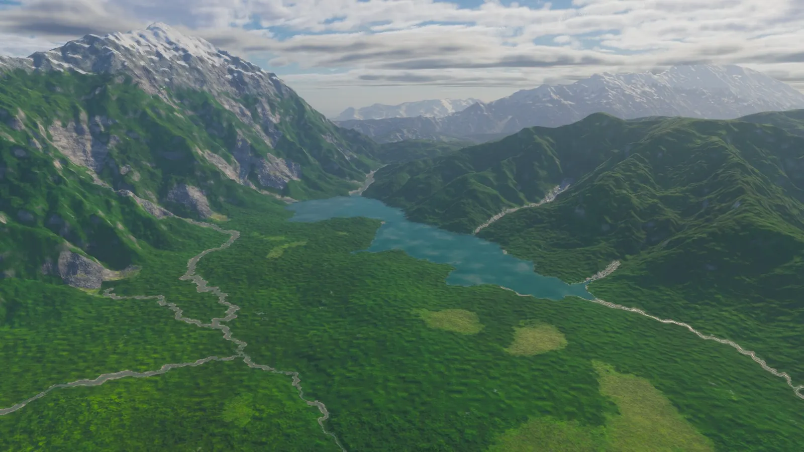
The island's map shows 2,585 hollows that could hold a lake, and three lakes. Walk onto any of the twenty-two floors in its hills, Binh Ninh's among them, and the ground lies level for a kilometre or two, as flat as water, with no water on it. One of them now holds a lake: Ho Lang, at the head of this page, on the floor where Binh Ninh stands, its water level with the sill at its outlet.
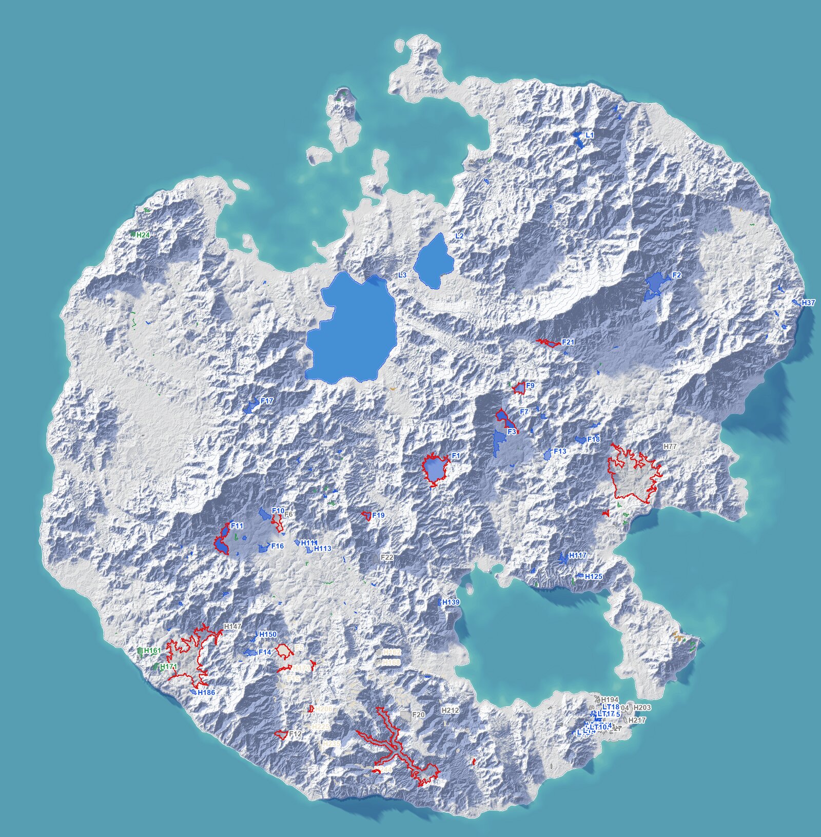
Every place on the island where water could stand, coloured by what it became: lakes blue, ponds green, dry salt flats pale, no lake grey. Only the three largest blue shapes, in the north, and Ho Lang hold water in the game today. A red ring marks a village standing in the water of its lake. (The lake store's second set, traced on 4 m ground, 2026-10-19.)
A lake bed with no lake#
The island's large relief was not drawn. It was grown: uplift raises the mountain belts, rivers cut them down, and a simulation balances the two over a long run of steps on a grid of nodes 64 m apart. At every step, water finds its way from each node to the sea. Where it cannot, it stands, filled to the height of its outlet.
Then the simulation does what a real lake does to itself. Sediment settles in still water, and at every step the floor of a flooded basin rises by a share of its depth. At the end of the run it tidies: any lake left shallower than 4 m, or smaller than 0.6 km², is filled to its outlet. Three lakes passed. Breitmeer covers 123 km² and stands 62 cm above the sea. Girpilio ezeras covers 22 km², 12 m up. Himinvatn covers 1.1 km² at 1,622 m, in the north-east mountains: the only lake that survived far above the sea.
The twenty-two floors are what the rest became. Twenty-one lie level to within 0.7–0.8 m, a standard deviation, across up to 5.8 km²; the last, 1,706 m up, to 1.2 m. On the 4 m ground, twelve of the sixteen we measured lie within half a metre of the height at which their basin overflows: the mark of a lake filled to its brim. The map records no water on any of them.
2,585, counted from a map#
To find every other place water could stand, we flooded the island from the sea on a 32 m map. The flood fills each hollow to its spill level, and it found 2,585 hollows of at least a hectare and a metre deep. Half are smaller than 1.6 ha; the deepest one per cent go down more than 60 m. The 251 of at least 5 ha and 3 m we traced again on the finished ground, sampled every 4 m.
A quarter of the largest vanished, nearly all of them on rivers. Of the 251, 188 still hold a hollow of a hectare and a metre: 149 of the 157 away from rivers, but only 39 of the 94 with a river running through. At 32 m a river's channel is narrower than a cell, so the map reads the river bed as a dam, and a hollow forms behind it. At 4 m the channel is there, and the water runs out. One hollow that promised 20 ha of lake at 32 m holds 1.9 ha at 4 m, its outlet 4.3 m lower.
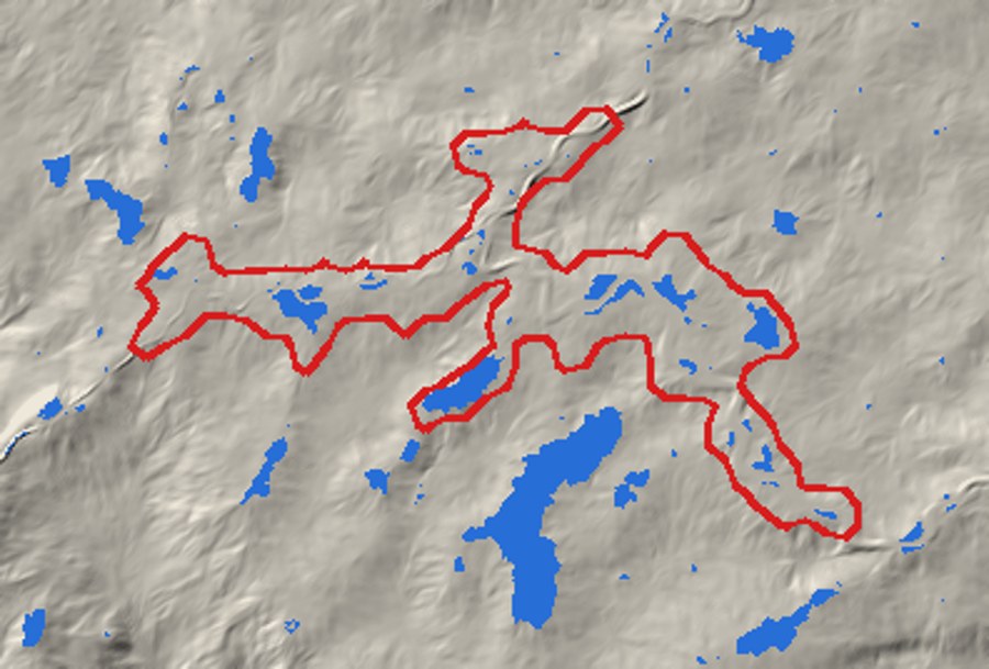
One hollow at two grains. Red: the 20 ha lake the 32 m map promised. Blue: where the 4 m ground holds water 30 cm deep or more. Most of the promise drains through a channel that runs along the outline's spine.
Walls that trap their own rivers#
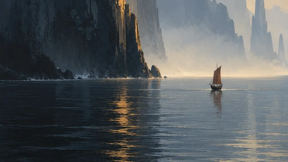
The four largest hollows are the strangest. A sea cliff on this island is raised by the height of its wall, 500 m at the middle of the Weeping Wall, and the raise tapers away over the next few kilometres inland. Behind a tall wall, the land is left lower than the lip: a closed bowl. Behind the Weeping Wall the bowl covers 27 km² and is 136 m deep, and twelve villages stand on its floor. Its river climbs the last 650 m to the lip, then falls 170 m into the sea.
Three of the bowls are not to be lakes: filled, they would drown 24 villages and some 13,000 people. The fourth, a small one in the east, may be one day: a lake held at 75 m behind a notch cut through the sea wall, falling 75 m into the sea, with Karang Pinang on its shore. It is still a proposal.
The rain decides#
A hollow is a place water could stand. Whether it does is a question of water. Each was weighed against the rain over its catchment, scaled by its realm's wetness, and against the evaporation off its own surface.
- The Sandstone Desert and the Lava Tip get no rain at all. 60 of their hollows are dry salt flats, white crusts that never hold water.
- A lake that loses more to the air than its rivers bring shrinks and turns salt.
- A small or shallow one is a pond, or a fen.
- Every lake that remains overflows all year. In the monsoon east, Ho Lang rises half a metre in the rains. In the north, Hatunqucha lies under ice for three months and peaks at the March thaw.
Each lake also has a colour, by the rules real lakes keep: turquoise under snow, tea-brown where peat drains in, jade-green in the warm east, milky where clay washes in, acid green over the black sand of the lava.
A name older than its count#
The Lava Tip has no rain, so its one long river is a dry wash. The plan gives it a chain of lakes anyway, fed by warm springs that rise along the lava. Its name is older than any count of it: Saat Sar, the seven lakes. On the 32 m map the stair held eight lakes, each at least 2 m below the one above; at 4 m it holds eighteen waters, five lakes and thirteen pools.
The names run from the moon at the source to tears at the sea. Chandsar, the moon lake, is a lava pit 60 m deep at 309 m. Sheeshasar, the mirror lake, is the largest, 45 ha. Ansoosar, the lake of tears, the last before the sea, turned out to be a pool of one hectare. The chain kept its name.
Its nearest real kin is Band-e Amir, in Afghanistan's Hindu Kush: six lakes behind dams of travertine, the mineral that springs lay down.
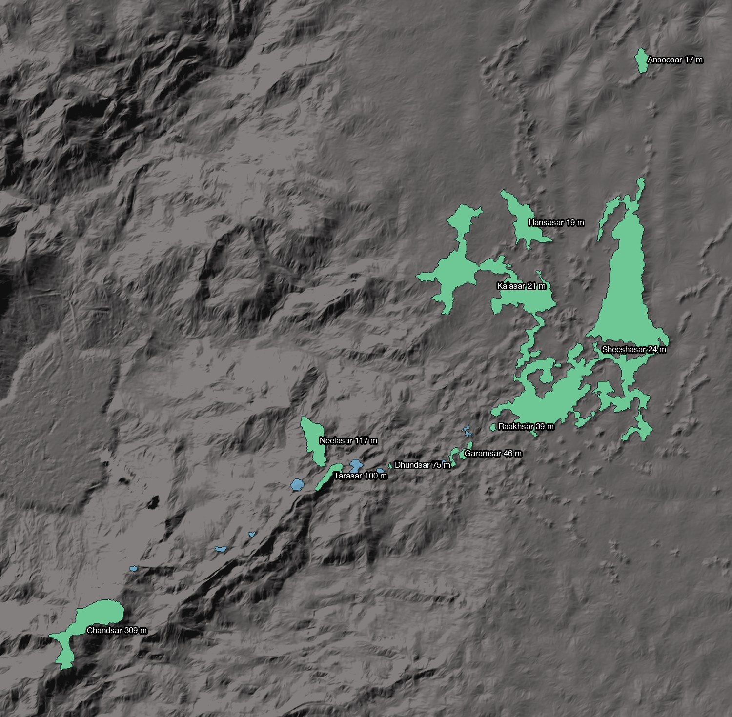
Saat Sar from above: the named waters in green with their levels, the unnamed pools in blue. North is up; the sea lies just past Ansoosar. From Chandsar to Ansoosar the stair falls 292 m.
Lakes above their rims#
The planned lakes went wrong once more before they were right. The first plan stood the water two metres over each floor. On the whole-island map, eight of the twenty-two basins have a rim lower than that. On the 4 m ground most of the floors are not closed at all: they drain through channels the 32 m map cannot see. Our sampling boxes had cut the outlines short, and two lakes, Ho Lang and Ho Guong, met through the saddle Binh Ninh stands on.
So each planned lake now stands at its planned depth, never above its basin's rim, and every narrow neck it would drain through is recorded as an outlet to build. An outlet can take one of three forms: a fall over a sill, a wide open outlet, or two channels about an island. An island like that is a site for a fortress, as Trakai's castle stands on its island in Lake Galvė.
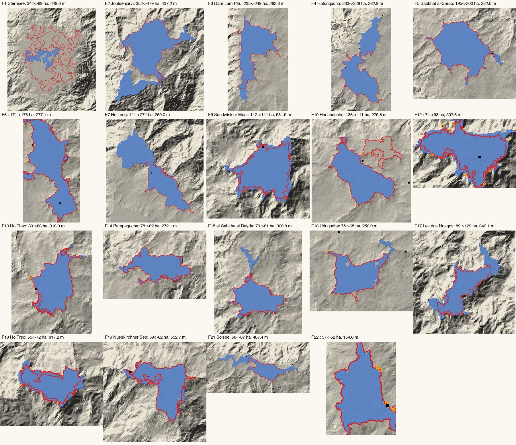
The planned lakes, the first plan in red and the corrected one in blue, both traced on 4 m ground. The red outlines' straight edges are our sampling boxes, not shores.
Held within their basins, the lakes reached further than the first plan, and three more villages stood in their water. Sternsee posed a choice: kept small, 71 ha of reeds below a dry Tiefenberg, or let fill to 756 ha with Tiefenberg's bay in the water.
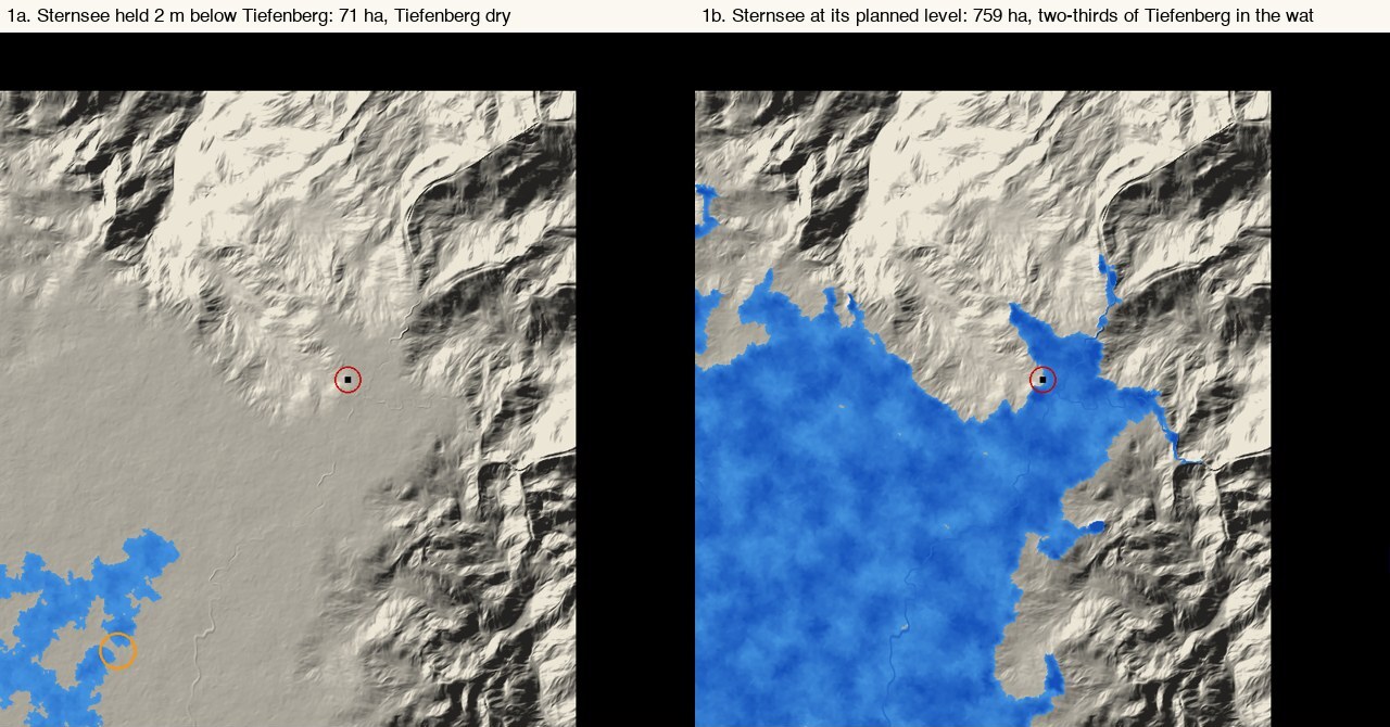
Sternsee held two metres below Tiefenberg (left) and at its planned level (right). The red circle is 60 m across the village's middle.
It was let fill. Tiefenberg, Sandwinkel, Nusskirchen and Rotenenheim become lake villages on piles, beside Binh Ninh and Waynaqullqa: six in all. Their real kin are the prehistoric pile dwellings around the Alps. UNESCO lists 111 of them, nine on the shores of Lake Constance in Baden-Württemberg.
A name for every water#
Each lake has a name in the tongue of the villages around it, weighted by their people and their nearness: the tongues of twelve cultures in all. Some names say what a lake measures, some are poetic, and a few borrow a village's name. Each language's grammar had to come out right:
| Name | Language | Meaning |
|---|---|---|
| Sternsee | Germanic | star lake, where, the villages say, a star once fell |
| Ho Lang | Vietnamese | the still lake |
| Hatunqucha | Quechua | the great lake |
| Sabkhat al-Sarab | Arabic | the salt flat of the mirage |
| Petit Lac | Norman | the little lake (petit goes before the noun) |
| Girpilio ezeras | Lithuanian | Girpilis's lake (the village's name in the genitive) |
| Himinvatn | Nordic | heaven lake |
A name keeps to its place. When a lake was traced again on finer ground, it found its name by the point the name was pinned to. That is how the chain's eight names held as the chain grew to eighteen waters.
What runs, and what is still water on paper#
- Runs: the lake store traces 294 outlines on 4 m ground and keeps them, with their levels, their low and high water, their outlets, colours and names. The three lakes the island already had are in the game.
- Runs, since 2026-10-21: Ho Lang, the first planned lake built into the terrain itself (Atlas 8c59aabb). Its water stands on the finished ground at the height of its outlet's sill, and the sill is built across the outlet's neck. The lake's low and high water are in the lake store; the game does not keep the seasons yet, so its water stands at one level, the sill's.
- An experiment: the judging. Which hollow becomes a lake, a pond, a salt flat or nothing is a set of rules, each tested, that we keep refining. Where a village stands in the water, the team decides.
- Planned: every other lake in this post. The other planned lakes, the Saat Sar chain and the lakes in natural hollows are not in the game yet. Binh Ninh's ground is under Ho Lang's water, but its houses on piles are still to be built, and none of the other five pile villages stands in water yet. The roads will bend round each lake as it is built, never the reverse, as they already do at Girpilio ezeras.
A floor that became a lake#
Binh Ninh's 2,370 people live on a floor that has become a lake. Ho Lang's water stands 1.1 m deep at the village's middle, and half a metre deeper in the rains.