Atlas #9 · The island's water, part 2 of 2
1.9 km of Road Ran Inside a Lake. Now It Keeps to the Shore
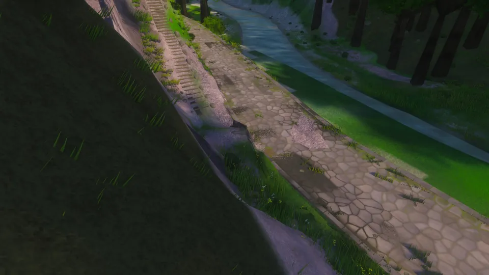
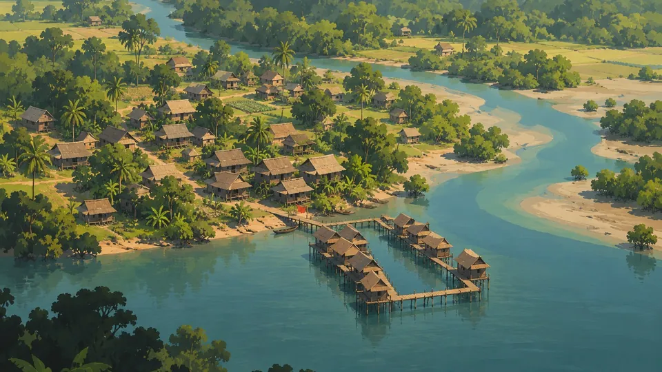
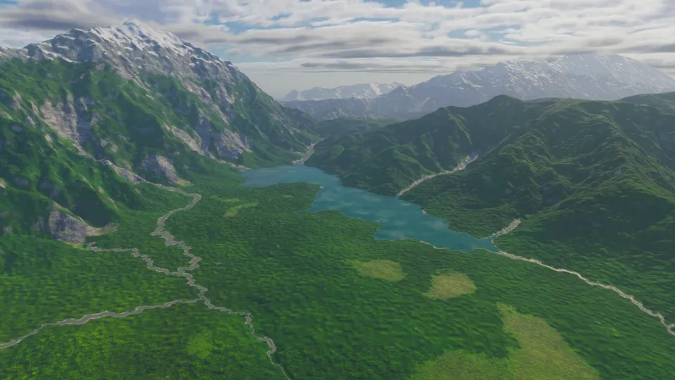
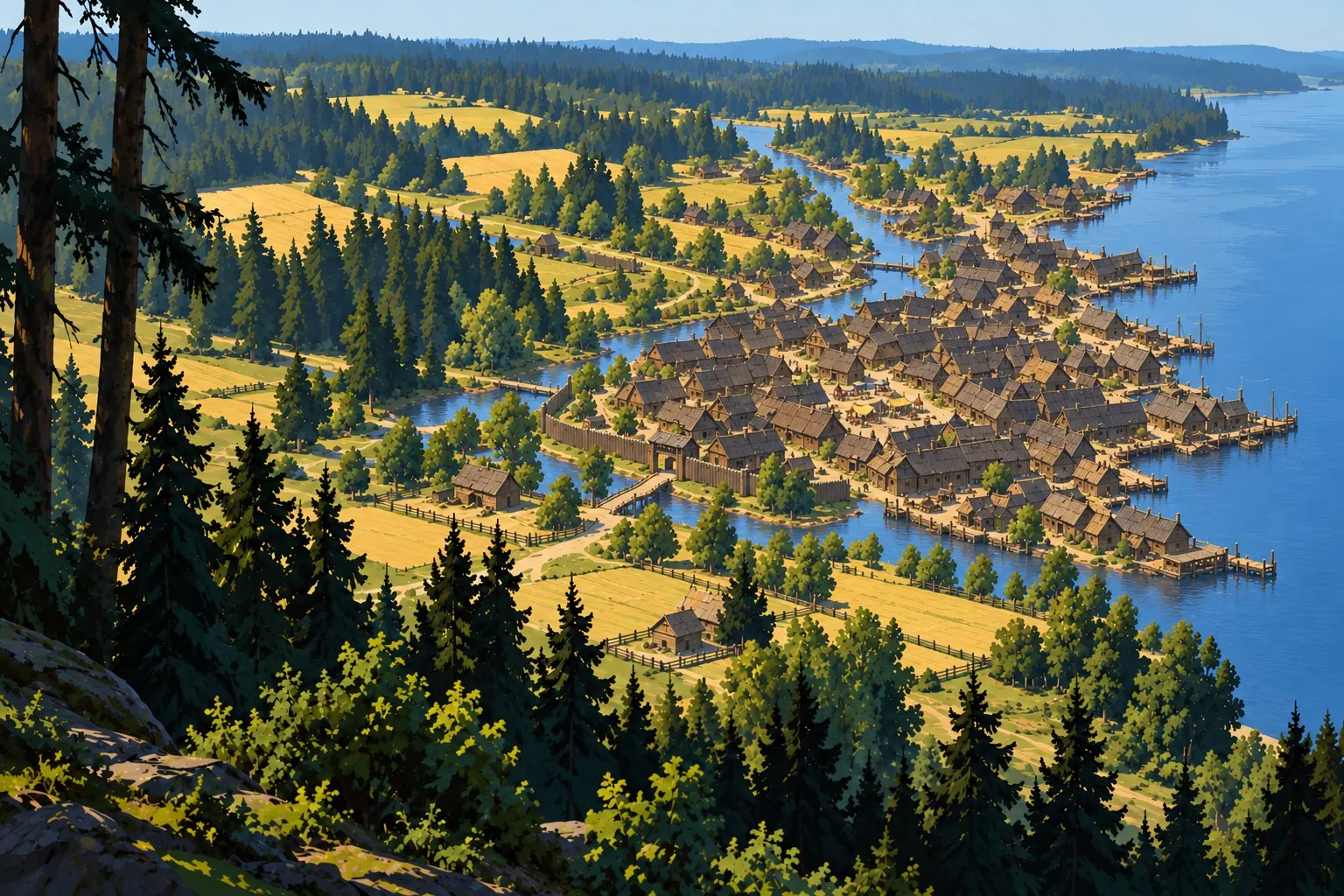
Concept art from the Atlas ontology: Girpilis, a timber boundary around the roofs (concept 440)
Follows on from Atlas #2: A Stair at Mavigol That Leads Back Where It Started
In this post
On the east shore of Girpilio ezeras, a lake of 22 km² in the Great Forest, a cart track ran 43 metres inside the water's outline, on ground 1.2 metres below the level of the lake beside it. All five tracks round the lake strayed in like that: 1,902 metres of road inside a lake, and only 38 of them over open water.
Now the eight stretches that strayed have been laid again on the shore behind, and every other point of the five tracks lies where it lay. On this island the roads give way to the lakes: where a shore is known exactly, the roads keep back from it. Across the same water a ferry now crosses, and in the north a path goes down to a lake that never thaws.
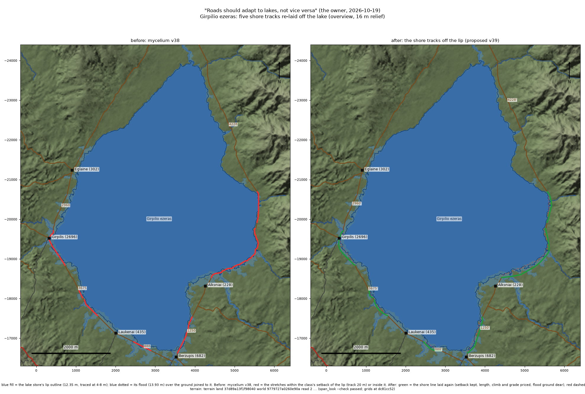
Girpilio ezeras, its water milky jade with clay. Left: the road record before (version 38), with the stretches that run inside the lake's outline, or within 20 m of it, drawn red. Right: those stretches as laid in version 39 (green); the old line is dashed. The picture was drawn while version 39 was still a proposal, and its own label says so. The pale blue that spreads up the river mouths is the lake at its April high water. Look at the south-east corner, by Alksniai: the old track ran along the water's edge for 2 km. A plan view at true scale on the game's terrain; the lit render is not made yet.
Why the lake gets the last word#
Atlas is a game set on one composed island, about 99 by 101 km, with 900 settlements. Their roads are not painted: they were grown, settlement by settlement, by a router that prices every metre of climb, every bridge and every ferry. The result is a network of 2,965 stretches of road between junctions, from paved highways to footpaths, and it is canonical. Nothing regenerates it. When something is wrong, it is corrected forward with a new, recorded step, as at Mavigol, and settlements never move.
Lakes were the vague part. The old terrain knew where its lakes were only to the nearest 32 metres. This week the terrain gained a lake store: every lake on the island traced as a polygon at 4 to 8 metres, with its level, its high water, its name and what kind of water it is. It holds 294 outlines: the three lakes the game already has; 22 planned ones, fourteen of them lakes, two more that join a neighbouring lake, and the rest salt flats or dry floors; the 18 lakes and pools of Saat Sar, a spring-fed chain on the Lava Tip; and 251 other hollows that could hold water. The store has its own story, in the companion post 2,585 Hollows and Three Lakes.
A lake with an exact shore is a promise to the player: this is where the water stops. A road that ignores it walks you into the reeds. The team's whole instruction was one line: "Roads should adapt to lakes, not vice versa." The lakes are fixed, and the roads move.
1,902 metres#
We measured every road on the island against every outline in the store, every 2 metres.
At two of the three lakes the game already has, nothing needed to move. No road comes near Himinvatn, high in the Snowbound North. On Breitmeer, the broad mere of the Temperate Middle, the only road inside the outline is the ferry from Grunwald: 9,015 m of open water, its landings 11 m and 27 m inside the shore, where a ferry's stone mole and jetty belong.
Girpilio ezeras was different. Five cart tracks ring it, and all five strayed into it: 1,902 m in eight stretches, as far as 43 m from the shore. The road record's own line ran as much as 2.5 m below the lake's surface. No village depended on those metres alone, but every village on the lake used them.
The planned lakes are a bigger job and a later one. On the store's first outlines, which are being redrawn as this is written, they would drown 21 km of road on 44 stretches, and five villages would lose their only way out. Those roads wait until the terrain actually holds the water. A road that swerves round a lake that isn't there yet is its own kind of nonsense.
Dry land below the waterline#
Here is the odd part. On today's map, only 38 of those 1,902 m are over water the game draws. The rest run on dry ground. How can a track be inside a lake and on dry land at once?
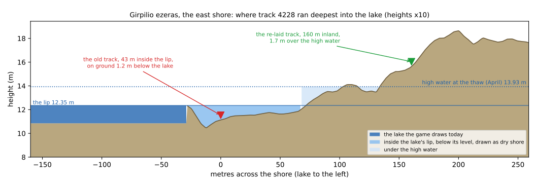
A cut across the east shore of Girpilio ezeras where the old track ran deepest, 43 m inside the outline. The lake the game draws stops at the dark blue. Behind it the ground dips as much as 1.9 m below the lake's level and stays below it for 96 m. The store counts that strip as lake, and so does physics: water at 12.35 m would pour straight in. The old track (red, version 38) ran down there, on ground 1.2 m below the lake. The re-laid one (green, as laid in version 39) stands 160 m from it, inland, 1.7 m above the April high water. The lake bed under the dark blue is not measured; its depth is drawn nominal. A profile cut from the game's terrain, not a render.
The store traces each lake at its true level over the finished ground. The game's water was drawn from coarser data. At Girpilio ezeras the two agree on 98 percent of the water, at Himinvatn on 95. The rest are low strips like this one, below the lake's level but drawn dry. At Alksniai one of them is about 130 m wide, a flat at 10.5 to 11.8 m beside a lake at 12.35 m. The old tracks ran on those strips because, on the router's coarser map, they were flat dry shore.
Wait, does that mean the game's lakes are too small? Slightly, yes. That goes back to the terrain session, with numbers attached. For the roads it settles the question of which shore to obey. We obey the store's.
Twenty metres back#
The whole fix fits in one sentence. A way keeps its distance from a lake's outline: 25 m for a stone road, 20 m for a cart track, 12 m for a footpath.
On the five tracks, every stretch that came inside that distance was cut out and laid again. The new line starts and ends on the old one, where the old one is clear of the setback by 10 m, and it joins it smoothly, without a kink. Between those points the new line is found the way the router finds any road: it pays for length, for climb, and for any grade steeper than 6 percent, and it is never steeper than the class allows. Every metre within 12 m of another road costs it six times over, so it never runs along one. Everything outside the re-laid stretches stays exactly as it was: 12,099 of the five tracks' 18,121 points did not move.
The rule bends a little where the ground is tight. The planner accepts a line that keeps nine tenths of the setback, and one stretch, north-west of Laukenai, comes within 18.6 m of the outline. The other seven keep their 20.
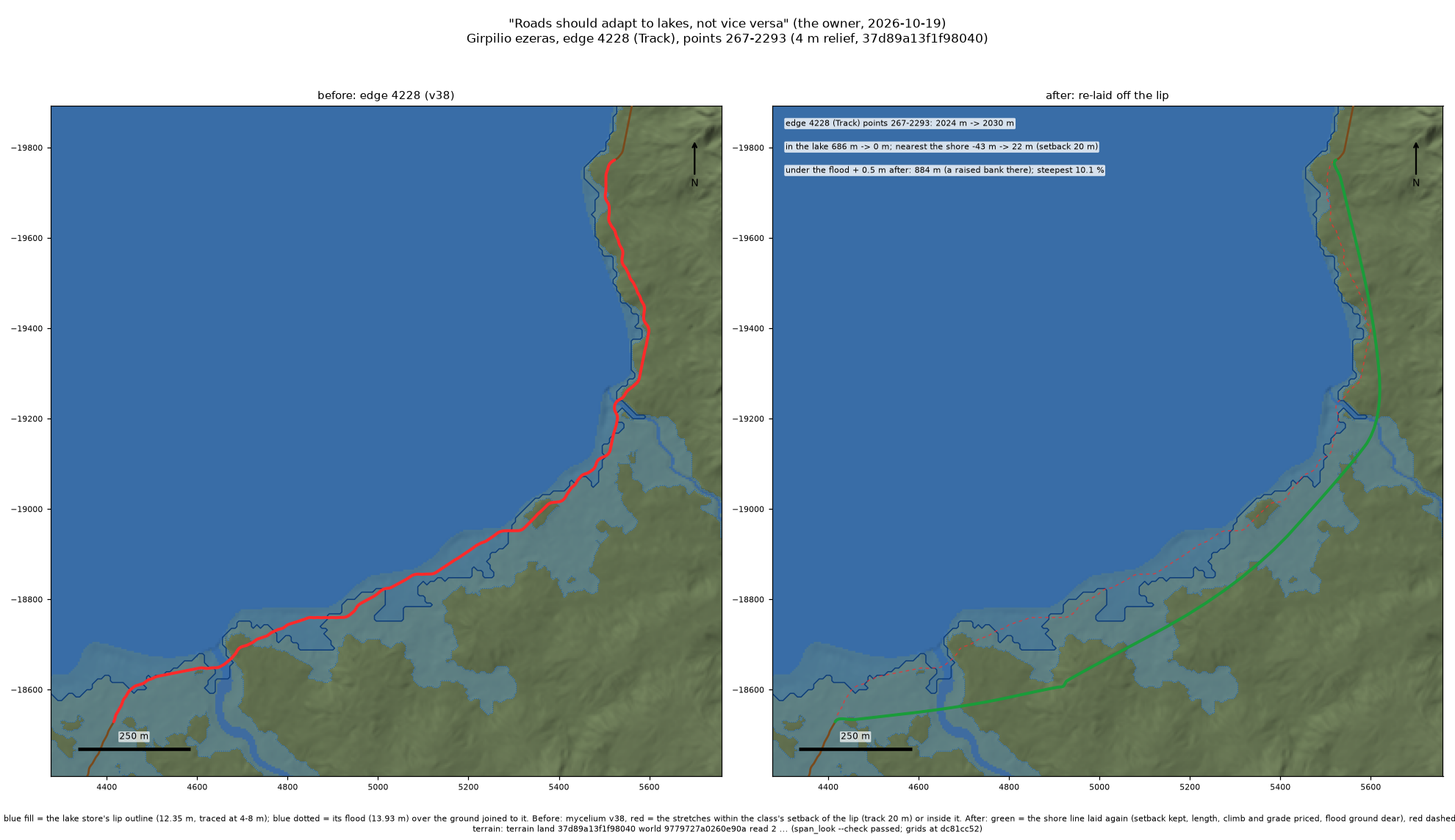
The longest re-lay, as laid in version 39: 2 km of the east shore track, which ran 686 m inside the lake. Now it keeps at least 21.8 m off the shore and crosses the river a little upstream of its mouth. The pale blue tongue up the river is the April flood. A plan view on the game's terrain; the lit render is not made yet.
The five tracks came out 137 m longer in all, 18,245 m against 18,108 m. The steepest new pitch is 14.5 percent, under a cart track's 18.
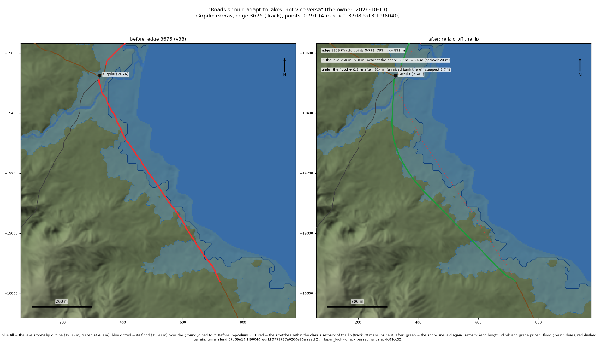
Below Girpilis (1,914 people), the town on the west shore, as laid in version 39. The track to Laukenai left the town along the water. Now it climbs a little behind the shore. The town itself stays where it is: its front on the lake is its own business. A plan view on the game's terrain; the lit render is not made yet.
Hug the shore or keep your feet dry?#
The rule left one real choice. Girpilio ezeras is a snowmelt lake: it peaks at the April thaw, 1.6 m over its lip, and a lot of the shore lies under that.
We tried both answers. The dry version priced flooded ground two and a half times dearer, and the tracks fled uphill. One stretch grew 30 percent longer, and they still ran 2.7 km on ground under the high water plus half a metre. The shore version priced it at 1.25 times: 6.2 km of new track instead of 6.6, within sight of the water most of the way, with 3.3 km in the flood band.
We chose the shore. The old tracks sat in that same band, so nothing got worse, and a lakeshore road should look at the lake. A low bank to carry the tracks over the April water, a causeway with culverts where the streams cross, is the natural next step. It is written down as a proposal, not built: the first version stays small.
What a ferry has to beat#
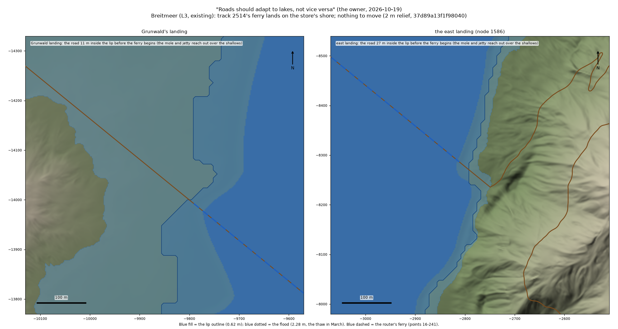
Breitmeer's ferry, both ends: in the road record long before the lake had an outline, and nothing here changes. It was laid by hand, and the outline agrees with it. Note the pale blue on the left: at the March thaw, by the store's reckoning, the flat behind Grunwald's landing stands in shallow water. That reckoning errs high, by design. Plan views on the game's terrain.
The road network already has a rule for when a long way round deserves a shortcut. When it linked neighbouring villages, it built a new road only if the old way by road was more than 1.5 times the new route. Ferries get the same test. Two villages on one lake get a ferry when the way round is over 1.5 times the way across.
From Girpilis to Alksniai, on the far south-east shore, the road runs 6.7 km round the south end. The ferry route is 4.1 km: 39 m from the town to its quay, 3.64 km over the water, and 451 m up from the far landing to the village. That is 1.62 times, so it passes.
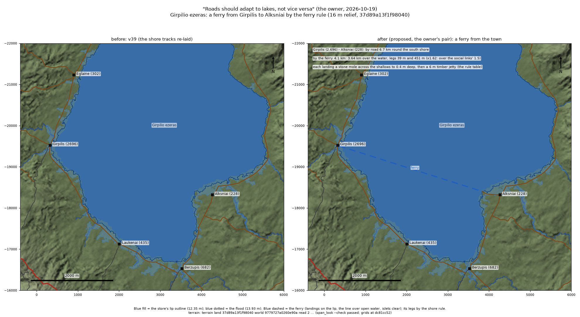
The ferry, laid in version 39 of the road record, with its far landing where it stands now: where the store's shore meets the drawn water, a 451 m walk from Alksniai, not out on the flat. Each landing will be what the road builder makes of every ferry: a low stone mole across the shallows to where the water stands 0.4 m deep, then a 6 m timber jetty. The lake has 7.3 km of open water for the wind to work on, and the store calls its waves stormy. The ferryman will have opinions about April. A plan view on the game's terrain.
The far landing moved once. It was first put on the shore nearest Alksniai, and it landed on that flat below the waterline: lake by the store, dry land by the game. The router's own ferry marking would have run the boat aground there. So landings now go where the store's shore and the drawn water meet. The crossing got 210 m shorter, the walk up to Alksniai longer, and the ratio stayed 1.62.
A path down to the heaven lake#
Himinvatn means heaven lake. It lies at 1,622 m in the Snowbound North, 114 hectares of water that the store says is frozen all year: ice-white, turquoise beneath. Three villages stand round it, and none of them comes down to it. Their paths wind high around the lake. Djupadal and Ravntopp are 2.0 km apart as the raven flies and 7.9 km apart by road.
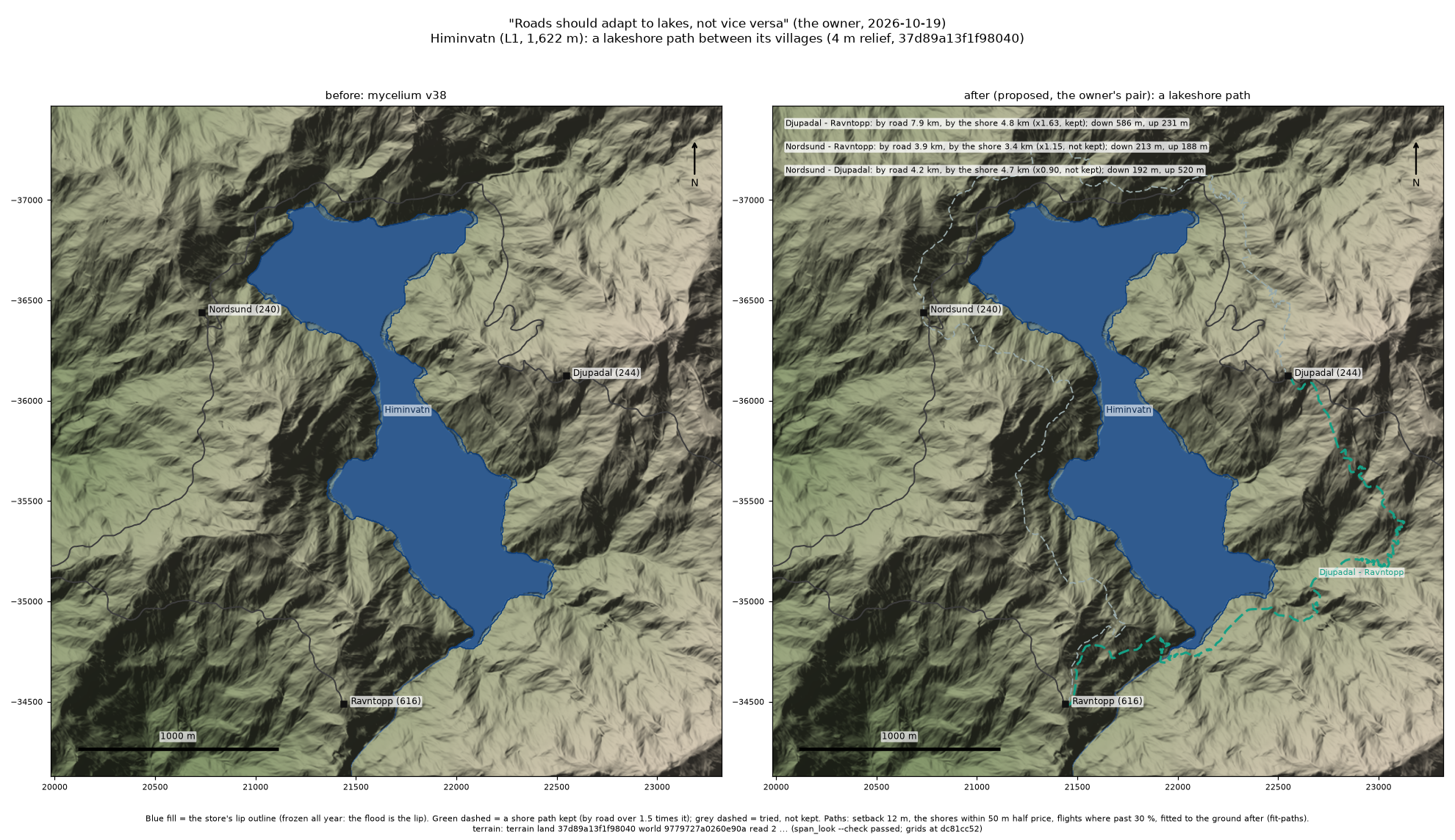
The path from Djupadal to Ravntopp, laid in version 39: 4.8 km, from Djupadal at 2,120 m down to the shore at 1,622 m, along the south-east end of the lake, and up to Ravntopp at 1,763 m: 586 m of descent and 231 m of climb in all, over the ups and downs between. Its steepest pitches reach 49 percent. Footpaths go up in steps cut into the slope past 30 percent, so expect stairs. The two grey dashed lines were tried too and failed the test: Nordsund to Ravntopp would save only 1.15 times, Nordsund to Djupadal nothing. A plan view on the game's terrain.
It passes the same 1.5 test, at 1.63. A lake gets one such path at most, for the pair that gains most, and only where the shore earns it. Two paths along one shore would end up riding each other, and the network has a rule against that too.
Picture the walk from Djupadal: some 500 m of switchbacks down to a lake that never thaws, a stretch along its rim of ice, then the climb to Ravntopp, 3 km shorter than the high way round. Whether anyone skates is up to the people who live there.
Laid, and not yet#
- Laid: in version 39 of the road record, the five tracks round Girpilio ezeras re-laid, the ferry from Girpilis to Alksniai, its water open from landing to landing, and the path down to Himinvatn, checked before they landed: every one of the 900 settlements still connected.
- Not yet: lit renders of all of it, each view judged by a blind critic before it is shown; every figure above is a plan view or a profile on the game's own terrain. The low bank over the April water is a proposal. The planned lakes, and the roads across them, wait for the water.
Hollows that wait for water#
The three lakes in this post were the easy ones: the water was already there. The planned lakes lie in hollows that are dry today, and on the store's first outlines 21 km of road runs across them. One town, Binh Ninh, will stand in its lake on piles, a stilt village, and its stone road crosses the floor that will become Ho Lang. Saat Sar steps down the lava from 309 m to 17 m, eighteen spring-fed lakes and pools, and the only road to touch it is the Hundred Arches, some 29 m over Ansoosar, its lowest pool.
When those lakes fill, the roads will have to choose again, shore by shore: hug or climb, go round or take the boat. Which of them will earn a ferry, and who will be waiting at the landing when they do?